SGSLR
For over 40 years, NASA's global network of satellite laser ranging (SLR) stations has provided a significant percentage of the global orbital data used to define the International Terrestrial Reference Frame (ITRF). The current NASA legacy network is reaching its end-of-life and a new generation of systems must be ready to take its place. Scientific demands of sub-millimeter precision ranging and the ever-increasing number of tracking targets give aggressive performance requirements to this new generation of systems. Using lessons learned from the legacy systems and the successful development of a prototype station, a new network of SLR stations, called the Space Geodesy Satellite Laser Ranging (SGSLR) system, is being developed. These stations will be state-of-the-art SLR components of NASA's Space Geodesy Project.
SGSLR development is underway, starting at the Goddard Geophysical and Astronomical Observatory (GGAO), and highlighted on the GGAO site news webpage.
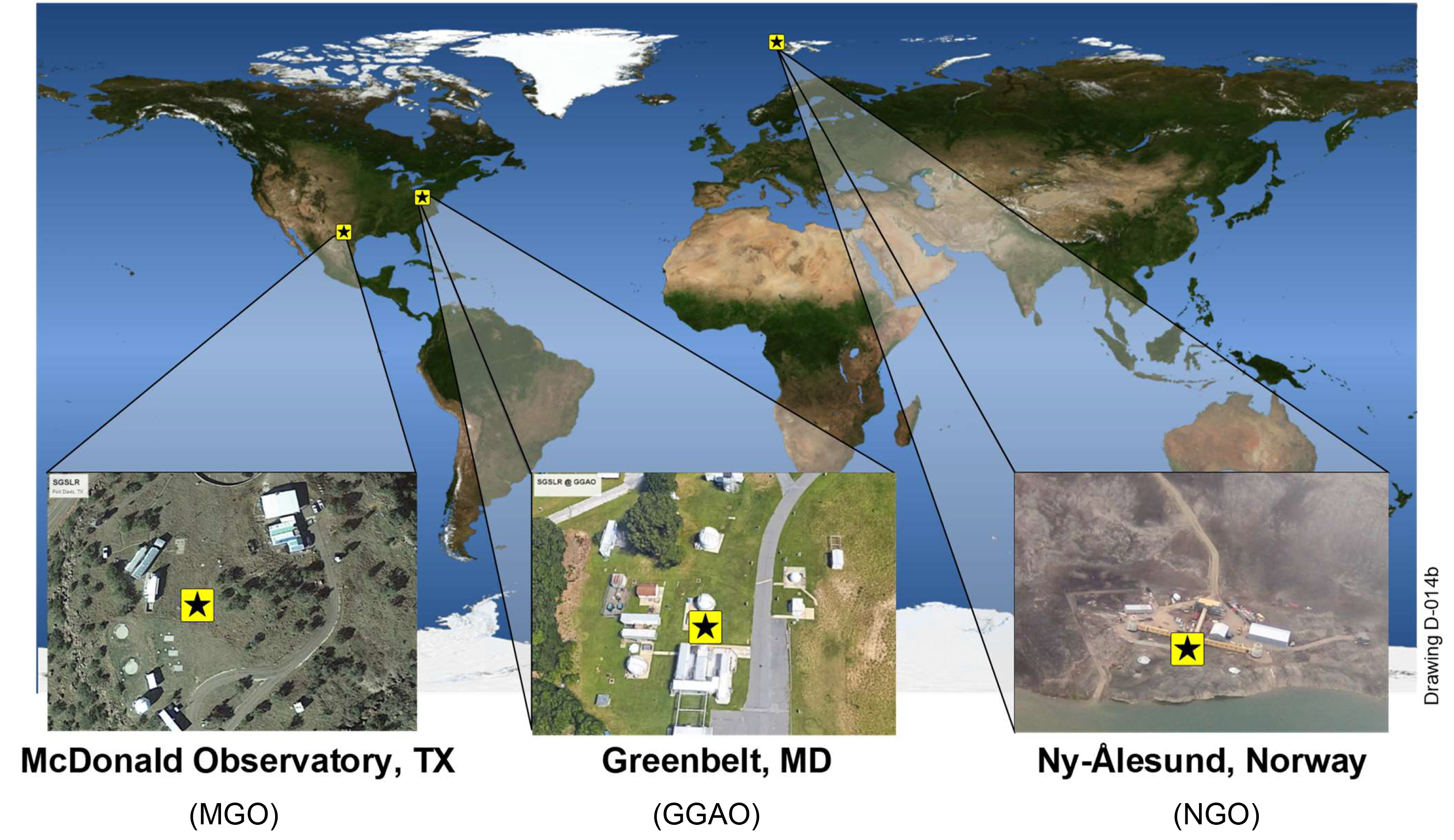
Locations of the three new SGSLR stations

Schematic diagram of the outside of the SGSLR station and shelter
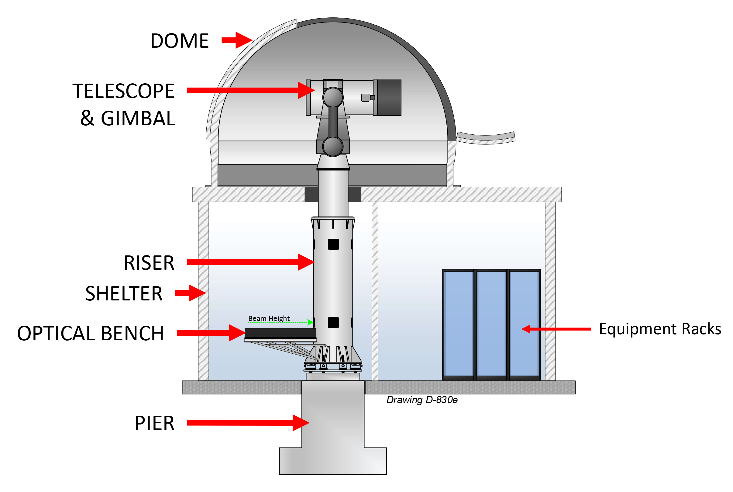
Schematic diagram of the inside of the SGSLR station and shelter
Related Links:
- GGAO site news
- SGSLR/NGSLR project documentation
- Hoffman, E., SGSLR: Development of a New Generation of Satellite Laser Ranging Stations, presented virtually as a NASA GSFC Geodesy & Geophysics Laboratory Seminar, August 8, 2020
- McGarry, J.F., Hoffman, E.D., Degnan, J.J. et al., NASA's satellite laser ranging systems for the twenty-first century, J Geod (2018). doi: https://doi.org/10.1007/s00190-018-1191-6
- SGSLR Critical Design Review (September 05-06, 2018)