Project Overview
"Precise Geodetic Infrastructure: National Requirements for a Shared Resource," published by National Acadamies Press
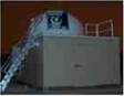
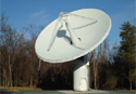
The global geodetic infrastructure is comprised of several networks and individual ground stations for: Very Long Baseline Interferometry (VLBI), Satellite Laser Ranging (SLR), Global Navigation Satellite Systems (GNSS), and Doppler Orbitography and Radiopositioning Integrated by Satellite (DORIS). NASA's Space Geodesy Program contributes to the global infrastructure through the deployment, operation, and maintenance of two coordinated networks: the NASA Space Geodesy Network (NSGN) of collocated VLBI, SLR, GNSS, and DORIS stations, and the NASA Global GNSS Network (GGN). The data produced by these networks is used for a variety of products, including: the definition of the International Terrestrial Reference Frame (ITRF), measurement of the Earth Orientation Parameters, and satellite precision orbit determination. The data and products from these networks are also used to support a broad range of scientific and societal applications in areas such as Earth observations, positioning, navigation, and timing.
Many of the geodetic stations are decades old and are not capable of meeting future requirements. The US National Research Council (NRC) Committee on Earth Science and Applications from Space concluded in 2007 that: "The geodetic infrastructure needed to enhance or even to maintain the terrestrial reference frame is in danger of collapse." NASA and many other international government agencies are responding to this conclusion by making new investments to modernize and expand their geodetic infrastructure.
The Space Geodesy Program is implementing NASA's response to the NRC recommendation by sustaining and operating NASA's legacy Space Geodesy Networks while executing the construction, deployment, and operation of the next generation Space Geodesy stations that will be part of a new NSGN. The Space Geodesy Project (SGP) deployment strategy is guided by the recommendations of the NRC Committee on the National Requirements for Precision Geodetic Infrastructure, as well as the plans of other nations for contributing to the Global Geodetic Observing System (GGOS). One of the main objectives of the SGP is to produce the necessary observations to realize a Terrestrial Reference Frame that has an accuracy of 1 mm (decadal scale) with stability at 0.1 mm/year (annual scale). This is an ambitious goal, as it represents an order of magnitude improvement over the current capability.
NASA's Space Geodesy Program encompasses the development, deployment, operation, and maintenance of a global network of space geodetic observatories consisting of geodetic and associated instruments, a data collection and transfer system, analysis, and the public dissemination of data products required to maintain a stable terrestrial reference system, measure the Earth Orientation Parameters, and support NASA’s missions and the scientific community. The primary goals of the SGP are to:
- Contribute to the maintenance and improvement of a stable Terrestrial Reference Frame (TRF) that meets the needs of NASA's Earth orbiting missions, Earth Surface and Interior Focus Area, and deep space navigation
- Contribute to measurements of Earth orientation parameters (EOP) that meet the needs of NASA's Earth orbiting missions, Earth Surface and Interior Focus Area, and deep space navigation
- Contribute to determining accurate precision orbits to meet the needs of NASA's geodetic, Earth observation, navigation and space science missions
To meet the goals, the Space Geodesy Program has the following objectives:
- Operate and maintain the NASA Space Geodesy Network, and provide the underlying geodetic measurements from the geodetic stations
- Develop and deploy a next generation NASA Space Geodesy Network of collocated geodetic stations
- Collaborate and partner with the international geodetic community for the operation, maintenance, and improvement of the global geodetic infrastructure, and the space-geodetic data analysis and data product dissemination
- Collaborate and partner with related space flight missions having geodetic needs and applications