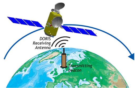
What is DORIS?
The Doppler Orbitography by Radiopositioning Integrated on Satellite (DORIS) was developed in France by the Centre National d'Etudes Spatiales (CNES) with the cooperation of Groupe de Recherche en Géodésie Spatiale (GRGS) and the Institut Géographique National (IGN). The system was developed to provide precise orbit determination and high accuracy location of ground beacons for point positioning. An accurate measurement is made of the Doppler shift on radiofrequency signals emitted by the ground beacons and received on the spacecraft.
DORIS is a dual-frequency Doppler positioning system; current missions with on-board DORIS receivers are SPOT-2, -4, and -5, Envisat, Jason-1 and -2, and CryoSat-2. Future missions carrying DORIS receivers include SARAL/AltiKa Ka-band altimeter instrument; past missions include TOPEX/Poseidon and SPOT-3. Unlike many other navigation systems, DORIS is based on an uplink device. The receivers are on board the satellite while the transmitters are on the ground. This creates a centralized system in which the complete set of observations is downloaded by the satellite to the ground center, from where they are distributed after editing and processing.

The DORIS technique


