2016 Project News
 Draft RFP for the SGSLR Network Build released
12/21/2016The Draft RFP for the SGSLR Network Build has been released and can be found at https://www.fbo.gov/notices/6f8c20c871522bb73badfcc073374ab2.
 Special collection
of DORIS-related titled, "The Scientific Applications of DORIS in Space Geodesy", published in the journal "Advances in Space Research"
12/06/2016The International DORIS Service (IDS) has just published in the journal "Advances in Space Research" a special collection of papers entitled "The Scientific Applications of DORIS in Space Geodesy". DORIS is one of the four fundamental techniques that contributes to the terrestrial reference frame. It is also a prime tracking technique for LEO satellites, including those that map the oceans with radar altimetry.
The eighteen papers in the special issue cover five themes:
- ITRF2014 -- the papers discuss the DORIS contribution to the new realization of the International Terrestrial Reference Frame (ITRF);
- DORIS Ultra-Stable Oscillator (USO), Jason-2;
- Precise Orbit Determination;
- DORIS System and Network;
- Intertechnique comparisons of DORIS products.
The papers are published in Volume 58, Number 12 of the Journal Adv. Space Res. Of the 18 papers, four were led or featured significant contributions from NASA GSFC & JPL authors. The Guest Editors of the special issue were Frank G. Lemoine (Code 61A, Geodesy & Geophysics Laboratory, NASA GSFC) and Ernst J.O. Schrama (Faculty of Aerospace Engineering, Delft University of Technology, Delft, The Netherlands).
This special issue marks the third time the DORIS community has published a special issue in a peer-reviewed journal dedicated to scientific and technical aspects of the DORIS technique. The previous special issues dedicated to DORIS were published in the journal Adv. Space Res. (two volumes in 2010) and in the Journal of Geodesy (2006).
The papers of the current special issue (Vol. 58(12), Adv. Space Res, 2016) are available from the following URL:
http://www.sciencedirect.com/science/journal/02731177/58/12
A full list of the papers with DOI and page numbers is provided below:
Advances in Space Research
Volume 58, Issue 12, Pages 2477-2774 (15 December 2016)
Scientific Applications of DORIS in Space Geodesy
Edited by Frank G. Lemoine and Ernst J.O. Schrama
Lemoine, F.G., and E.J.O. Schrama, "Preface: Scientific Applications of DORIS in Space Geodesy", Adv. Space Res., 58(12), 2477-2478, 2016, doi: 10.1016/j.asr.2016.11.002.
ITRF2014
Moreaux, G., Lemoine, F.G., Capdeville, H., Kuzin, S., Otten, M., Štěpánek, P., Willis, P., Ferrage, P., "The International DORIS Service contribution to the 2014 realization of the International Terrestrial Reference Frame", Adv. Space Res., 58(12), 2479-2505, doi: 10.1016/j.asr.2015.12.021.
Bloßfeld, M., Seitz, M., Angermann, D., Moreaux, G., "Quality assessment of IDS contribution to ITRF2014 performed by DGFI-TUM", Adv. Space Res., 58(12) 2505-2519, doi:10.1016/j.asr.2015.12.016.
Lemoine, F.G.; Chinn, D.S.; Zelensky, N.P.; Beall, J.W.; Le Bail, K., in press., "The Development of the GSFC DORIS Contribution to ITRF2014", Adv. Space Res., 58(12), 2520-2542, doi: 10.1016/j.asr.2015.12.043.
Soudarin, L., Capdeville, H., Lemoine, J.-M., "Activity of the CNES/CLS Analysis Center for the IDS contribution to ITRF2014", Adv. Space Res., 58(12), 2543-2560, doi: 10.1016/j.asr.2016.08.006.
Kuzin, S., Tatevian, S., "DORIS data processing in the INASAN Analysis Center and the contribution to ITRF2014", Adv. Space Res., 58(12), 2561-2571, doi: 10.1016/j.asr.2016.07.010.
Khelifa, S., "Noise in DORIS station position time series provided by IGN-JPL, INASAN and CNES-CLS Analysis Centres for the ITRF2014 realization", Adv. Space Res., 58(12), 2572-2588, doi: 10.1016/j.asr.2016.06.004.
DORIS Ultra Stable Oscillator (USO)- Jason-2
Belli, A., Exertier, P., Samain, E., Courde, C., Vernotte, F., Jayle, C., Auriol, A., "Temperature, radiation and aging analysis of the DORIS Ultra Stable Oscillator by means of the Time Transfer by Laser Link experiment on Jason-2", Adv. Space Res., 58(12), 2589-2600, doi: 10.1016/ j.asr.2015.11.025.
Jayles, C., Exertier, P., Martin, N., Chauveau J.P., Samain E., Tourain C., Auriol A., Guillemot P., "Comparison of the frequency estimation of the DORIS/Jason2 oscillator thanks to the onboard DIODE and Time Transfer by Laser Link experiment", Adv. Space Res., 58(12), 2601-2616, doi: 10.1016/j.asr.2015.08.033.
Willis, P., Heflin, M. B., Haines, B. J., Bar-Sever, Y. E., Bertiger, W. I., Mandea, M., "Is the Jason-2 DORIS Oscillator also Affected by the South Atlantic Anomaly?", Adv. Space Res., 58(12), 2617-2627, doi: 10.1016/j.asr.2016.09.015.
Precise Orbit Determination
Capdeville, H., Štěpánek, P., Hecker, L., Lemoine, J.M., "Update of the corrective model for Jason-1 DORIS data in relation to the South Atlantic Anomaly and a corrective model for SPOT-5", Adv. Space Res., 58(12), 2628-2650, doi: 10.1016/j.asr.2016.02.009.
Zelensky, N.P., Lemoine, F.G., Chinn, D.S., Beckley, B.D., Bordyugov, O., Yang, X., Wimert, J.; Pavlis, D., "Towards the 1-cm SARAL orbit", Adv. Space Res., 58(12), 2651-2676, doi: 10.1016/j.asr.2015.12.011.
Lemoine, J.M., Capdeville, H. Soudarin, L., "Precise orbit determination and station position estimation using DORIS RINEX data", Adv. Space Res., 58(12), 2677-2690, doi: 10.1016/j.asr.2016.06.024.
DORIS System and Network
Jayles, C.; Chauveau, J.P.; Didelot, F.; Auriol, A.; Tourain, C., "DORIS system and integrity survey", Adv. Space Res., 58(12), 2691-2706, doi:
10.1016/j.asr.2016.05.032. Tourain, C., Moreaux, G., Auriol, A., Saunier, J., "DORIS Starec ground antenna characterization and impact on positioning", Adv. Space Res., 58(12), 2707-2716, doi: 10.1016/j.asr.2016.05.013.
Saunier, J., Auriol, A., Tourain, C., "Initiating and error budget of the DORIS ground antenna position Genesis of the Starec antenna type C", Adv. Space Res., 58(12), 2717-2724, doi: 10.1016/j.asr.2016.02.013.
Saunier, J., "Assessment of the DORIS network monumentation", Adv. Space Res., 58(12), 2725-2741, doi: 10.1016/j.asr.2016.02.026.
Intertechinque Comparisons of DORIS Products
Tornatore, V., Tanır Kayıkçı, E., Roggero, M., "Comparison of ITRF2014 station coordinate input time series of DORIS, VLBI and GNSS", Adv. Space Res., 58(12), 2742-2757, doi: 10.1016/j.asr.2016.07.016.
Heinkelmann, R., Willis, P., Deng, Z., Dick, G., Nilsson, T., Soja, B., Zus, F., Wickert, J., Schuh, H., "Multi-technique comparison of atmospheric parameters at the DORIS co-location sites during CONT14", Adv. Space Res.,58(12), 2758-2773, doi: 10.1016/j.asr.2016.09.023.
 CDDIS successfully moves all primary operations to an upgraded computer system
12/01/2016The CDDIS successfully moved all primary operations to an upgraded computer system on December 01, 2016; in total, the CDDIS archive was inaccessible to the user community for approximately 30 hours during the transition. The new IT infrastructure provides a more robust, reliable, and expandable system with increased storage capacity to handle future growth. All suppliers of data, derived products, and ancillary files for the CDDIS archive were required to modify their software to use the HTTP protocol for file upload. In addition to new hardware, the CDDIS archive processing software was redesigned and improved to provide for more efficient operations and additional QC on incoming files.
 CDDIS unavailable November 30-December 01 for transition to new systems
11/17/2016On November 30, 2016 at 13:00 UTC, CDDIS will terminate all services (ftp, CDDIS/ILRS/SGP websites, data deliveries) as we transition to all new hardware and facilities. We are projecting about 24 hours to fully move to our new facilities and ensure all operations are back to normal. As such, all users need to plan on a 24+ hour disruption of service to the CDDIS archive with resumption of normal operations no earlier than December 01, 2016 at 17:00 UTC.
In summary the following will take place:
- 30 November 2016 at 13:00 UTC – All current production services (ftp, http, etc) will be shutdown.
- 01 December 2016 at 17:00 UTC – all web and anonymous ftp access is restored for access to the archive. NOTE: restoration could occur sooner but no guarantees are made.
- Currently used addresses, e.g., cddis.nasa.gov or cddis.gsfc.nasa.gov, will continue to work as before the transition. However, if you are using a numeric IP address to access any CDDIS resources your scripts will fail as all current IP addresses will change during the transition.
- 02 December 2016 – All CDDIS operations should be returned to normal service.
While CDDIS is unavailable, users can access one of the other data centers supporting the services:
- IGS: https://igs.org/data-access/#global-dcs
- ILRS:
http://ilrs.gsfc.nasa.gov/data_and_products/data_centers/index.html (check before November 30!)
- IVS: http://ivscc.gsfc.nasa.gov/about/org/components/dc-list.html
- IDS: http://ids-doris.org/data-products/info.html
 Space Geodesy Project Issues Solicitation for New VLBI Antennas
11/08/2016The Space Geodesy Project posted a request for proposal for the construction, deployment and commissioning of up to three Very Long Baseline Interferometer (VLBI) antennas that will be part of the new NASA Space Geodesy Network (NSGN) and the VLBI2010 Global Observing System (VGOS). Details on the solicitation can be found here: https://www.fbo.gov/spg/NASA/GSFC/OPDC20220/NNG16573944R/listing.html.
-
 Brief network outages at GSFC on September 03, 2016
08/30/2016 Work will be performed on the NASA GSFC network infrastructure from 09:00 a.m. EDT (13:00 UTC) through 05:00 p.m. EDT (21:00 UTC) on Saturday, September 03, 2016. Users may experience short intermittent interruptions in connectivity to CDDIS web and ftp sites during that time period.
Should the CDDIS be unaccessible, users can access one of the other data centers supporting the services:
- IGS: https://igs.org/data-access/#global-dcs
- ILRS:
http://ilrs.gsfc.nasa.gov/data_and_products/data_centers/index.html (check before September 03!)
- IVS: http://ivscc.gsfc.nasa.gov/about/org/components/dc-list.html
- IDS: http://ids-doris.org/data-products/info.html
- IGS: https://igs.org/data-access/#global-dcs
 User Profile: Dr. Erricos C. Pavlis
08/11/2016NASA Earthdata has published a user profile of Dr. Erricos Pavlis as part of their "Who uses NASA Earth science data?" series
 First Circular for the 20th International Workshop on Laser Ranging Released
07/19/2016GFZ Potsdam and the International Laser Ranging Service (ILRS) are pleased to announce that the 20th International Workshop on Laser Ranging will be held in Potsdam Germany during the week of October 09-14, 2016 at GFZ Potsdam, Telegrafenberg. The first circular has been released.
-
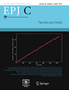
 LARES + LAGEOS 1&2 Lense-Thirring results selected as EPJ-C cover
07/19/2016The article, "A test of general relativity using the LARES and LAGEOS satellites and a GRACE Earth gravity model," (Ciufolini et. al.) has been published in the March 2016 issue of the European Physical Journal-C. Furthermore, a figure from this paper has been selected for the cover of that issue.
-
 The passing of Dr. Bob Coates
07/12/2016We are saddened to report the passing of Dr. Bob Coates, a long time colleague in the field of space geodesy. Bob was the Project Manager for NASA’s very successful Crustal Dynamics Project (CDP). Bob helped advance the SLR and VLBI technologies at NASA GSFC, incorporating them as the key measurement components of the CDP, which succeeded in describing the relative motions of the Earth’s plates with unprecedented accuracies. He will be remembered for his many contributions in both science and engineering, and for his guidance and encouragement to those who worked in the program.
-
 Positive leap second to be introduced
07/11/2016A positive leap second will be introduced at the end of December 2016.
-
 NASA Space Geodesy Data for Precise Orbit Determination of Altimeter Satellites Webinar (NASA Earthdata webinar series)
06/29/2016Over the last 25 years, ocean radar altimeter satellites have revolutionized our understanding of the world’s oceans. Today six altimeter satellites from different national and international space agencies synoptically measure the ocean surface topography in order to determine how the ocean surface changes with time. The heart of the altimeter measurement is the precise determination of the orbit reference which is used as the basis from which the changes in the ocean surface are determined. We now routinely determine the orbits of the joint NASA/CNES/NOAA/EUMETSAT missions Jason-2 and Jason-3 with a radial RMS precision of 1 cm.
This webinar describes how we can compute these orbits with such accuracy, and will further outline how these computations rely directly and indirectly on a suite of international Space Geodesy data as well as data from different NASA satellites. -
 Norway's contribution to the Global Geodetic Reference Frame
05/20/2016From the Norwegian Mapping Authority: Norway's contribution to the Global Geodetic Reference Frame: The Geodetic Earth Observatory in Ny-Ålesund, Svalbard. The UN General Assembly has adopted its first resolution recognising the importance of geodesy. Norway co-chaired work on the first UN resolution. Its most important contribution is the Norwegian Mapping Authority's geodetic Earth observatory in Ny-Ålesund on Svalbard. This is the northernmost facility of its kind, and plays a key role in a global network for observation and research. Data acquired here are important for climate research and monitoring.
-
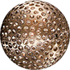
 Now 40, NASA's LAGEOS Set the Bar for Studies of Earth
05/04/2016On May 4, 1976, NASA launched a cannonball-shaped satellite that transformed studies of Earth’s shape, rotation and gravity field.
LAGEOS – short for Laser Geodynamic Satellite – was the first NASA orbiter dedicated to the precision measurement technique called laser ranging. With it, scientists have measured the movement of Earth’s tectonic plates, detected irregularities in the rotation of the planet, weighed it, and tracked small shifts in its center of mass.
Small deviations in the satellite’s orbit were used to develop early models of Earth’s gravitational field. Further perturbations in the orbit helped explain how sunlight heating small objects can affect their orbits, including near-Earth asteroids.
Read more...
-
 Data Chat: Carey Noll
04/28/2016 NASA Earthdata has published an interview with CDDIS Manager Carey Noll as part of their "Data chat" series.
Read more.... -
 NASA Station Leads Way for Improved Measurements of Earth Orientation, Shape
03/10/2016 NASA has demonstrated the success of advanced technology for making precise measurements of Earth’s orientation and rotation – information that helps provide a foundation for navigation of all space missions and for geophysical studies of our planet.
The technology includes a new class of radio antenna and electronics that provide broadband capabilities for Very Long Baseline Interferometry, or VLBI. This technique is used to make precise measurements of Earth in space and time.
VLBI measurements have been conducted for decades using a worldwide network of stations that carry out coordinated observations of very distant astronomical objects called quasars. To meet the demand for more precise measurements, a new global network of stations, called the VLBI Global Observing System, or VGOS, is being rolled out to replace the legacy network.
Read full article. -
 NASA Contributes to Global Standard for Navigation, Studies of Earth
02/25/2016 The surface of Earth is constantly being reshaped by earthquakes, volcanic eruptions, landslides, floods, changes in sea levels and ice sheets, and other processes. Since some of these changes amount to only millimeters per year, scientists must make very precise measurements of the landscape and ocean in space and time in order to study their evolution and help mitigate their impacts.
-
 Satellite Laser Ranging Research Geophysicist Position at NASA/GSFC
01/13/2016 The Sciences & Exploration Directorate, Solar System Exploration Division, Laser Remote Sensing Laboratory (Code 694) at NASA Goddard Space Flight Center is seeking a research scientist to provide expertise in space geodesy and Satellite Laser Ranging (SLR) system development and operations. As a Research Geophysicist, the successful candidate will be responsible for conducting, managing, planning, and directing the research and development of NASA’s next generation SLR stations. Conceives and conducts instrument and systems development to increase fundamental knowledge and understanding of space geodesy via SLR. Serve as a technical leader for the implementation of new NASA SLR stations as part of the NASA Space Geodesy Network (NSGN), and ensure the operational NSGN produces the data required by NASA missions and the scientific community. Identify problems and requirements for making geodetic SLR observations to best achieve an improved understanding of Earth dynamic processes, and initiating new experiments and programs to address these problems. Responsible for the development of new and novel applications of the SLR technique. Participate in the writing and publication of significant scientific and technological findings in appropriate journals and other media. Give presentations at scientific and technical meetings, both nationally and internationally. Responsible for defining, articulating, advancing, and publicizing NASA's role in the worldwide SLR community and participating in the direction of international organizations using SLR results and supporting SLR activities. This includes leading and supporting activities of the International Satellite Laser Ranging Service (ILRS). Work closely with NASA and NASA partner mission owners to develop SLR related requirements on the mission, associated retroreflectors, and the operational SLR network to meet the mission's science requirements. Applicants should have experience in instrument design, research and development of precision laser ranging and related optical measurement systems (such as SLR, LIDAR, and laser interferometers) and their application to space geodesy, geoscience, and/or Earth observations. Further information about NASA’s Space Geodesy Project can be found at: https://space-geodesy.nasa.gov.
U.S. citizenship is required. To view the full vacancy announcement, which contains further information including qualification requirements and application instructions, go to http://www.usajobs.gov/GetJob/ViewDetails/426383000. Applications must be received by February 29, 2016 via the USAJobs website. For additional questions, please contact Dr. Stephen M. Merkowitz at stephen.m.merkowitz@nasa.gov.
NASA GSFC is an Equal Opportunity Employer.


