2018 Project News
 Proceedings website for the 21st International Workshop on Laser Ranging now available
11/27/2018The proceedings website for the 21st International Workshop on Laser Ranging, held November 05-09 in Canberra Australia is now available with links to presentations, posters, and papers. Summary information is also available at the website.
 The Space Geodesy Project awards contract to KBRwyle Technology Solutions, LLC
10/5/2018The Space Geodesy Project awarded a contract to KBRwyle Technology Solutions, LLC in Columbia, Maryland, for the construction, deployment and commissioning of the agency’s next-generation Space Geodesy Satellite Laser Ranging (SGSLR) stations. https://www.nasa.gov/press-release/nasa-awards-contract-for-space-geodesy-satellite-laser-ranging-stations
 NASA Earth Science Data and Services Survey for 2018
10/01/2018Recently, some of you may have received an email from the CFI Group on behalf of NASA. This message asked you to complete a survey for users of NASA Earth science data and services, which includes the Crustal Dynamics Data Information System (CDDIS). The CDDIS is one of twelve NASA Earth Observing System Data and Information System (EOSDIS) science data centers evaluated by this survey. The purpose of this survey is to help NASA and the DAACs assess customer satisfaction and improve future services. Suggestions from past surveys have been implemented to improve the tools and services offered by the CDDIS.
Please participate! Your feedback affects our future performance and helps to identify science needs. You will be able to take the survey for each DAAC you use. This is your opportunity to influence the priorities of the DAACs, including CDDIS.
If you did not receive a survey and wish to complete one or know of someone who uses CDDIS and/or EOSDIS data and services who did not receive a survey, please contact
The American Customer Satisfaction Index (ACSI) is the only national cross-industry measure of customer satisfaction in the United States. NASA commissioned the CFI Group, an independent research and consulting organization, to conduct a brief survey to rate the products and services NASA currently provides from NASA's EOSDIS data centers. Please consider responding to this survey; your input will help us to better serve our user community.
Presentations of these results given to NASA Earth science are available at:
https://earthdata.nasa.gov/about/system-performance/american-customer-satisfaction-index-reports
Thank you in advance to all of you who are willing to spend a few minutes to complete the survey.
- Second Circular for the 21st International Workshop on Laser Ranging Released
06/06/2018The Space Environment Research Centre (SERC) and the International Laser Ranging Service (ILRS) are actively organizing the 21st International Workshop on Laser Ranging in Canberra, Australia during the week of November 05-09, 2018. The second circular has been released. Registration is now open and attendees are encouraged to submit an abstract for oral and poster sessions.
 Celebrating 50 years of transatlantic geodetic radio science
04/06/2018Fifty years ago this week, in April 1968, an historic event took place involving MIT Haystack Observatory radio telescope in Westford, Massachusetts, and its counterpart at Onsala Space Observatory in Onsala, Sweden: the first transatlantic geodetic very long baseline interferometry (VLBI) observations.
This occasion marks an important anniversary in geodesy; although the April observations were not entirely successful in terms of usable data, as VLBI was in its very earliest days, it was the first time that geodetic VLBI was performed across the Atlantic.
Today, NASA's Space Geodesy Project (SGP) operates a worldwide system of modern geodetic sites, including the broadband VGOS (VLBI Global Observing System) network, in collaboration with international partners around the globe.
 New NASA VLBI Civil Servant position open for applications
03/13/2018A new NASA VLBI Civil Servant position is now posted and open for applications. There are two postings, one senior and one mid-level, and applicants should decide which one best fits his/her experience level:
GS-14: http://www.usajobs.gov/GetJob/ViewDetails/493509700
GS-15: http://www.usajobs.gov/GetJob/ViewDetails/493510000
The postings currently close on Tuesday, March 27, 2018. Please note that the job is only open to U.S. citizens and U.S. nationals.
 New MIT Haystack Observatory blog for NASA/SGP-related activities
03/07/2018The MIT Haystack staff have started a blog which visually documents some of the NASA/SGP-related activities including KPGO, GGAO, Westford, and the MGO development.
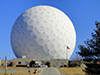
 UNAVCO News: The NASA Space Geodesy Project -- An Update
02/24/2018NASA’s Space Geodesy Project (SGP) was initiated in order to develop and maintain a global network of next-generation space geodetic observing instruments. Core sites around the globe will use three or four of the primary space-geodetic techniques: Very Long Baseline Interferometry (VLBI), Satellite Laser Ranging (SLR), Doppler Orbitography by Radiopositioning Integrated on Satellite (DORIS), and the Global Navigation Satellite System (GNSS). Deployments of these instruments with next-generation measurement capabilities have been underway since 2011.
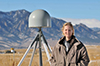 Earthdata User Profile: Dr. Kristine Larson
02/23/2018EOSDIS/Earthdata recently profiled a user of CDDIS data. Dr. Kristine M. Larson explores how a technology such as GPS can be used for applications beyond its original intent.
- EOSDIS awarded the 2015 Pecora award
02/14/2018EOSDIS was awarded the 2015 Pecora award. This prestigious award is given to groups that make outstanding contributions toward understanding the Earth by means of remote sensing. The citation highlights the EOSDIS accomplishments in providing an open archive system for a global user community. CDDIS is one of twelve DAACs supporting EOSDIS efforts through the Earth Science Data and Information System (ESDIS) project. Carey Noll, CDDIS Manager, accepted their award certificate from Andy Mitchell, ESDIS Project Manager, and Jeanne Behnke, Deputy Project Manager/Operations, at the 2018 DAAC Managers Meeting.
- First Circular for the 21st International Workshop on Laser Ranging Released
02/02/2018The Space Environment Research Centre (SERC) and the International Laser Ranging Service (ILRS) are pleased to announce that the 21st International Workshop on Laser Ranging will be held in Canberra, Australia during the week of November 04-09, 2018 at the John Curtin School of Medical Research (Australian National University) and Mount Stromlo. The first circular has been released.