2019 Project News
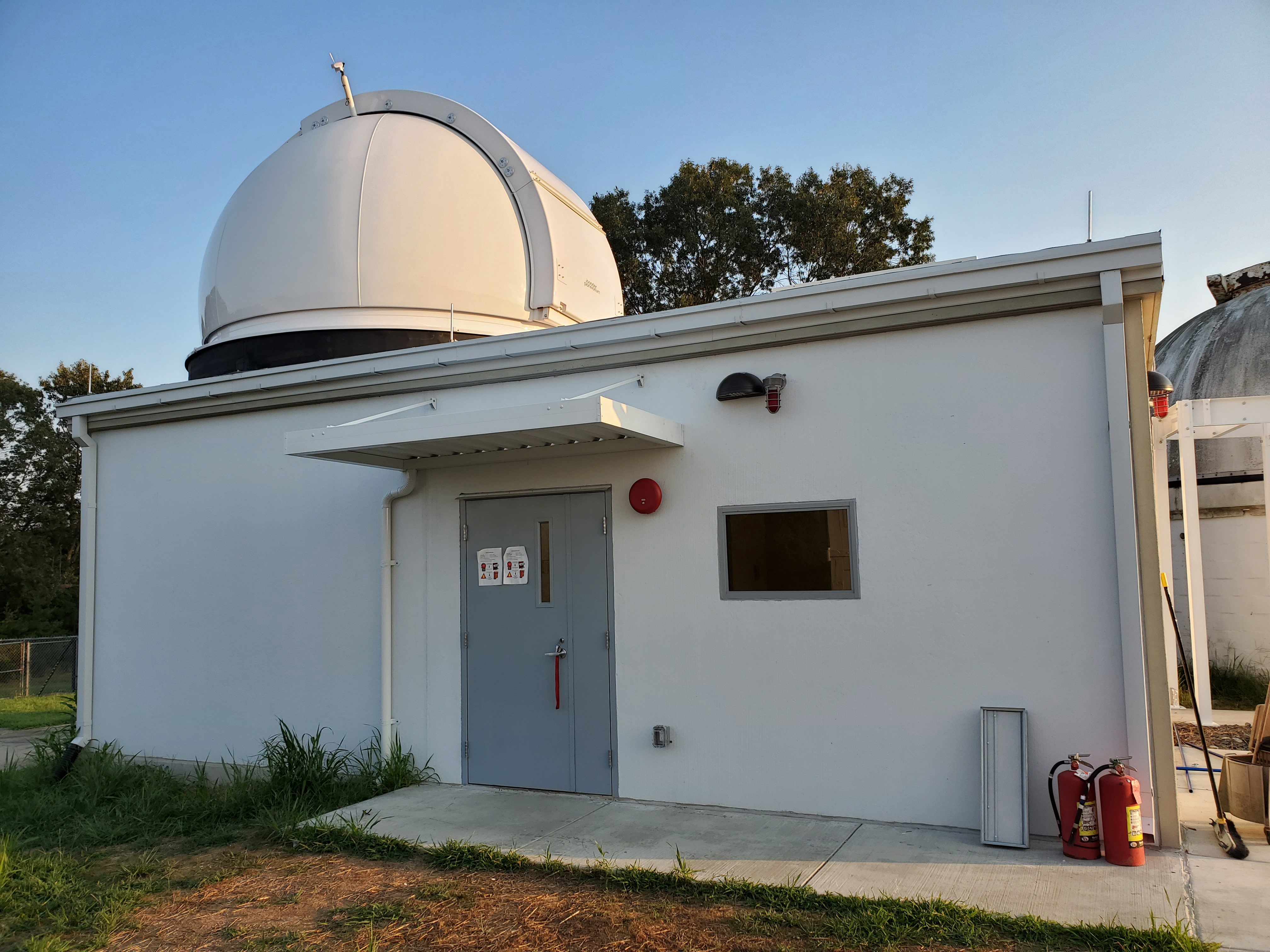
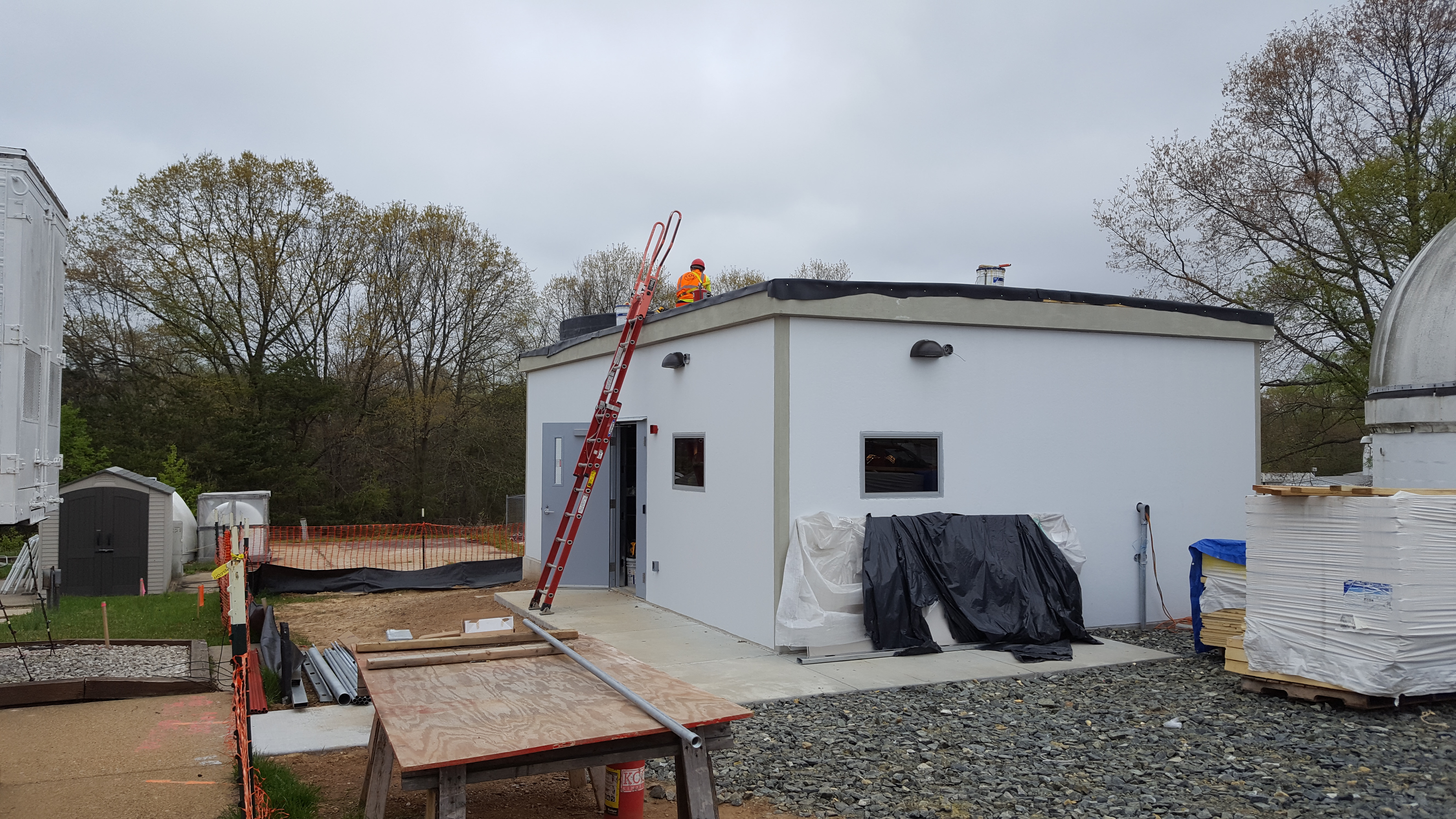
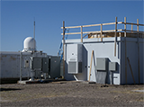
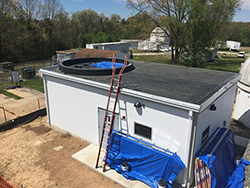
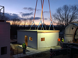
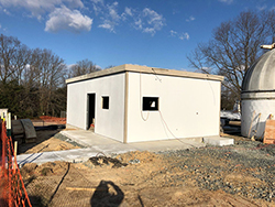
 MGO SGSLR shelter is built and ready to accept the dome
11/26/2019The MGO SGSLR shelter is built and getting ready to accept the dome. This picture shows the temporary roof covering the dome ring wall and protecting that part of the roof where the hole for the gimbal is located. Dome installation is expected at the end of January 2020.
 SGP version of GEODYN software now publicly available.
11/25/2019The SGP is making available to the public a version of the GEODYN orbit determination and geodetic parameter estimation software tool. A full description of the software and download options are available here:
https://space-geodesy.nasa.gov/techniques/tools/GEODYN/GEODYN.html. Journal of Geodesy "Special Issue: Satellite Laser Ranging" now published
Release Date: 11/25/2019 The Journal of Geodesy has recently published the "Special Issue: Satellite Laser Ranging" (Volume 93, Issue 11, November 2019, editors Erricos Pavlis, Vincenza Luceri, Toshimichi Otsubo, Ulrich Schreiber). This issue consists of twenty papers detailing recent developments in SLR:
Preface to the second special issue on Laser Ranging, Pavlis, E.C., Luceri, V., Otsubo, T. et al. J Geod (2019) 93: 2159. https://doi.org/10.1007/s00190-019-01305-2
The ILRS: approaching 20 years and planning for the future, Pearlman, M.R., Noll, C.E., Pavlis, E.C. et al. J Geod (2019) 93: 2161. https://doi.org/10.1007/s00190-019-01241-1
Laser geodetic satellites: a high-accuracy scientific tool, Pearlman, M., Arnold, D., Davis, M. et al. J Geod (2019) 93: 2181. https://doi.org/10.1007/s00190-019-01228-y
Lunar Laser Ranging: a tool for general relativity, lunar geophysics and Earth science, Müller, J., Murphy, T.W., Schreiber, U. et al. J Geod (2019) 93: 2195. https://doi.org/10.1007/s00190-019-01296-0
Information resources supporting scientific research for the international laser ranging service, Noll, C.E., Ricklefs, R., Horvath, J. et al. J Geod (2019) 93: 2211. https://doi.org/10.1007/s00190-018-1207-2
The next generation of satellite laser ranging systems, Wilkinson, M., Schreiber, U., Procházka, I. et al. J Geod (2019) 93: 2227. https://doi.org/10.1007/s00190-018-1196-1
NASA’s satellite laser ranging systems for the twenty-first century, McGarry, J.F., Hoffman, E.D., Degnan, J.J. et al. J Geod (2019) 93: 2249. https://doi.org/10.1007/s00190-018-1191-6
Modernizing and expanding the NASA Space Geodesy Network to meet future geodetic requirements, Merkowitz, S.M., Bolotin, S., Elosegui, P. et al. J Geod (2019) 93: 2263. https://doi.org/10.1007/s00190-018-1204-5
Future SLR station networks in the framework of simulated multi-technique terrestrial reference frames, Glaser, S., König, R., Neumayer, K.H. et al. J Geod (2019) 93: 2275. https://doi.org/10.1007/s00190-019-01256-8
Impact of network constraining on the terrestrial reference frame realization based on SLR observations to LAGEOS, Zajdel, R., Sośnica, K., Drożdżewski, M. et al. J Geod (2019) 93: 2293. https://doi.org/10.1007/s00190-019-01307-0
Satellite laser ranging to low Earth orbiters: orbit and network validation, Arnold, D., Montenbruck, O., Hackel, S. et al. J Geod (2019) 93: 2315. https://doi.org/10.1007/s00190-018-1140-4
Rapid response quality control service for the laser ranging tracking network, Otsubo, T., Müller, H., Pavlis, E.C. et al. J Geod (2019) 93: 2335. https://doi.org/10.1007/s00190-018-1197-0
Transitioning the NASA SLR network to Event Timing Mode for reduced systematics, improved stability and data precision, Varghese, T., Ricklefs, R.L., Pavlis, E.C. et al. J Geod (2019) 93: 2345. https://doi.org/10.1007/s00190-019-01326-x
Systematic errors in SLR data and their impact on the ILRS products, Luceri, V., Pirri, M., Rodríguez, J. et al. J Geod (2019) 93: 2357. https://doi.org/10.1007/s00190-019-01319-w
Time bias service: analysis and monitoring of satellite orbit prediction quality, Bauer, S. & Steinborn, J. J Geod (2019) 93: 2367. https://doi.org/10.1007/s00190-019-01304-3
Operating two SLR systems at the Geodetic Observatory Wettzell: from local survey to space ties, Riepl, S., Müller, H., Mähler, S. et al. J Geod (2019) 93: 2379. https://doi.org/10.1007/s00190-019-01243-z
Time and laser ranging: a window of opportunity for geodesy, navigation, and metrology, Exertier, P., Belli, A., Samain, E. et al. J Geod (2019) 93: 2389. https://doi.org/10.1007/s00190-018-1173-8
Laser and radio tracking for planetary science missions—a comparison, Dirkx, D., Procházka, I., Bauer, S. et al. J Geod (2019) 93: 2405. https://doi.org/10.1007/s00190-018-1171-x
Assessment of the impact of one-way laser ranging on orbit determination of the Lunar Reconnaissance Orbiter, Löcher, A. & Kusche, J. J Geod (2019) 93: 2421. https://doi.org/10.1007/s00190-018-1200-9
Version of a glass retroreflector satellite with a submillimeter "target error", Sokolov, A.L., Akentyev, A.S., Vasiliev, V.P. et al. J Geod (2019) 93: 2429. https://doi.org/10.1007/s00190-019-01260-y
Studies on the materials of LARES 2 satellite, Paolozzi, A., Sindoni, G., Felli, F. et al. J Geod (2019) 93: 2437. https://doi.org/10.1007/s00190-019-01316-z
 The 2019 ILRS Technical Workshop presentations and other information now available
Release Date: 11/06/2019 The 2019 ILRS Technical Workshop was held October 21-24, 2019 in Stuttgart, Germany. In addition, the first "SLR School" was held prior to the workshop on October 20. All abstracts, presentations, posters, and summary information from the workshop and the SLR School are available on the website:
https://ilrs.gsfc.nasa.gov/2019_Technical_Workshop- SLR Pioneer Certificates presented by Toshi Otsubo at the 2019 ILRS Technical Workshop
Release Date: 11/01/2019 During the 2019 ILRS Technical Workshop, Toshi Otsubo, chair of the ILRS Governing Board, presented the "SLR Pioneer Certificate" to the following recipients:
Victor Shargorodskiy (Research-and-Production Corporation «Precision Systems and Instruments«/ Moscow, Russia)
"In recognition of his role in the building and deploying of the ROSCOSMOS SLR network"
John McK. Luck (Geoscience Australia, retired/Canberra, Australia)
"In recognition of his work in establishing SLR activities in Australia and Western Pacific Laser Tracking Network"
Carey Noll (NASA GSFC/Greenbelt MD, USA)
"In recognition of her dedication, vision and creativity in supporting all aspects of the ILRS"
At the conclusion of the workshop, a "Recognition of Appreciation" certificate was presented to:
Daniel Hampf (DLR, Stuttgart, Germany)
"In recognition of the outstanding support provided in organizing and hosting the 2019 ILRS Technical Workshop, Stuttgart, Germany"
Congratulations to the recipients!  MGO SGSLR shelter goes up
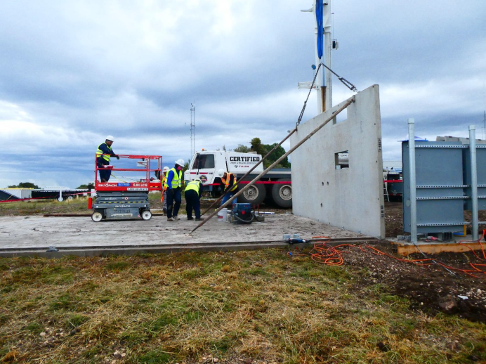
Release Date: 10/15/2019 The MGO SGSLR shelter walls were installed on the SGSLR pad on October 15th. The first picture shows the first wall panel going into place. The dome ring wall was added after the building walls and roof were in place. Work continues on the framing, electrical, ducting and other parts of the interior.
The first wall panel going into place
The shelter after the dome ring wall was added

Framing and electrical work inside the shleter
 The Jason-2 mission has ended
Release Date: 10/04/2019 The Jason-2/Ocean Surface Topography Mission (OSTM), the third in a U.S.-European series of satellite missions designed to measure sea surface height, successfully ended its science mission on Oct. 1. NASA and its mission partners made the decision to end the mission after detecting deterioration in the spacecraft's power system.
Read more about the Jason-2 mission...
 NASA’s Space Geodesy Project Mapping Out a Bright Future
Release Date: 10/02/2019 The Space Geodesy Project is featured in a new article published today on NASA's website. The article explains the role played by Very Long Baseline Interferometry (VLBI) in a variety of applications. SGP Manager, Stephen Merkowitz, explains the basic principle of VLBI, its most important function of building the International Terrestrial and Celestial Reference Frames, and the next generation of VLBI stations being installed in the US and around the world.
Read the full VLBI article on nasa.gov...
 Passing of James Leroy Long (1955 - 2019)
Release Date: 09/30/2019 The Space Geodesy Project is mourning the loss of our dear friend and colleague James Leroy Long who passed away on September 21, 2019 from prostate cancer complications.
Jim was a leader and essential contributor to the nation's space geodesy programs over the past 40 years. Jim began his career in 1978 as a Commissioned Officer within the US Department of Commerce NOAA Corps. For two years, Jim was the Party Chief for the transportable 5-meter antenna system collecting Very Long Baseline Interferometry (VLBI) data in support of the NASA Crustal Dynamics Program and the NOAA National Crustal Motion Network. These measurements led to the first measurements of continental drift. Jim also spent several years on mobile field duty for the U.S. Coast & Geodetic Survey performing precise horizontal control surveys and special project surveys. He also spent 2.5 years on board a NOAA National Ocean Service hydrographic survey ship performing horizontal and vertical control surveys, collecting hydrographic survey data for updating navigational charts, and ship board operations.
In 1984, Jim went to work for what eventually became Honeywell Technology Solutions as the Lead Civil Engineer for a multi-disciplinary group providing architectural and engineering services to the Federal Government, including NASA. He was responsible for precise geodetic surveys in support of the NASA Satellite Laser Ranging (SLR) Program, the NASA VLBI Program, as well as NOAA, USAF, and USN satellite tracking and communications stations. He was also responsible for precise geodetic surveys for installation and/or refurbishment of 9-meter unified S-band antennae at NASA STDN satellite tracking stations located all around the world.
In 2009, Jim came to GSFC as the Lead Civil Engineer in the Facilities Engineering Branch. Jim's experience and expertise in VLBI and SLR was quickly recognized by the Space Geodesy Project (SGP), so he started splitting his time between his Facilities duties and becoming the lead for the SGP Vector Tie System (VTS). Jim led the development of an automated system for monitoring the stability of a geodetic site. He successfully implemented a prototype of the system at the Goddard Geophysical and Astronomical Observatory, which is the basis for the VTS being implemented at all next-generation SGP sites. Jim's unique expertise and passion for space geodesy led him to transition full time to SGP within the Sciences and Exploration Directorate where he took on multiple roles as the VLBI Operations Manager, VTS Lead, and the Site Development Lead.
One of Jim's particularly notable accomplishments is the production of geodetic site ties for numerous NASA geodetic sites. These ties are essential for combining the measurements from the different geodetic techniques in the realizations of the International Terrestrial Reference Frame (ITRF) that is used by all Earth Observation satellites to geolocate their measurements on the Earth’s surface. The location of the origin of all of NASA's global geodetic stations on the ITRF is now known to within 1.5 mm thanks to Jim's expertise and dedication to the grueling task of global surveying. Without the precision geodetic surveys and analysis that Jim led, the quality of the ITRF would not be as good as it is today. Jim's accomplishments to geodetic site ties are internationally recognized and Jim was a critical member of the International Earth Rotation and Reference Systems Service Working Group on Site Survey and Co-location.
A memorial gathering to celebrate Jim's life will take place on Saturday, November 9, 2019 at St. Joseph Catholic Community in the Formation and Fellowship Center in Sykesville, MD from 2:30 pm – 5:30 pm. All are welcome to attend this Celebration of Life.
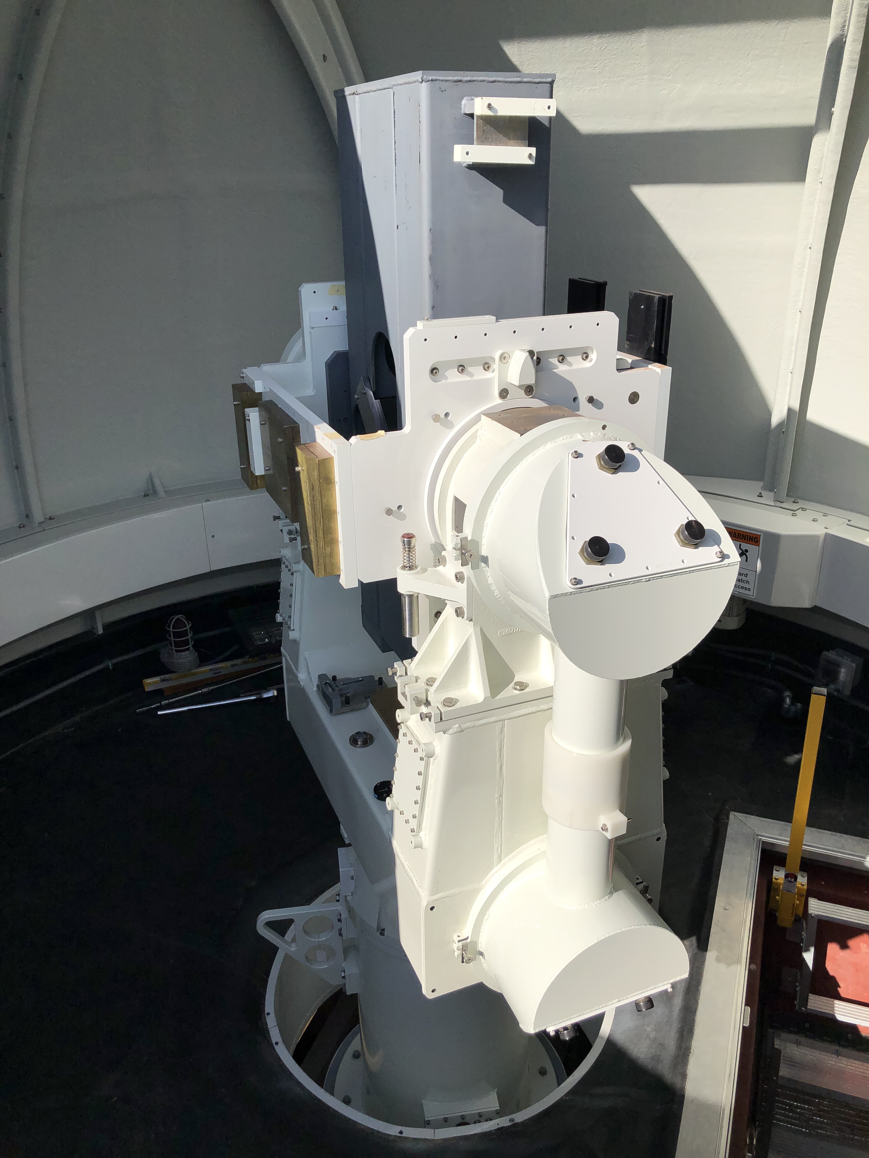
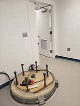
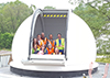
 Gimbal and Mass Simulator installed at GGAO on September 19, 2019
Release Date: 09/30/2019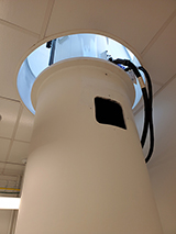
The riser bolted to the pier
Gimbal #1 and mass simulator (GMS) were crated and shipped from Cobham in Lansdale PA and delivered to GGAO early in the week of September 16th. The riser, which is needed to mate the pier with the gimbal, was also delivered to GGAO early that week.
The riser was lifted by crane into place through the dome slit in the SGSLR shelter early in the morning of the 19th and bolted to the pier.
Later that morning, once the riser installation was complete, the GMS was lifted by crane through the dome slit into place in the SGSLR dome area and attached to the top of the riser.
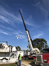
GMS being lifted by a crane
Power and servo controller cables were connected to the GMS. Later that same day, Cobham employees were able to move the mount under computer control through the servo controller. This was followed by NASA/KBR connecting their computer and moving the mount.
The final levelling of the mount still needs to be done, and offsets for the encoders must be determined before star calibrations can be attempted. The mass simulator has a tertiary mirror (no primary or secondary mirrors) but we expect to be able to see enough stars to do a rough initial star calibration.

Installed GMS
This installation will allow NASA/KBR to test the performance of the gimbal and also checkout the GTA test software. Meanwhile in Lansdale, Cobham is working to complete gimbal #2 and test it. Once the first telescope is ready, gimbal #1 will be shipped back to Lansdale and mated with the telescope in preparation for the first Gimbal and Telescope Factory Acceptance Test (FAT).
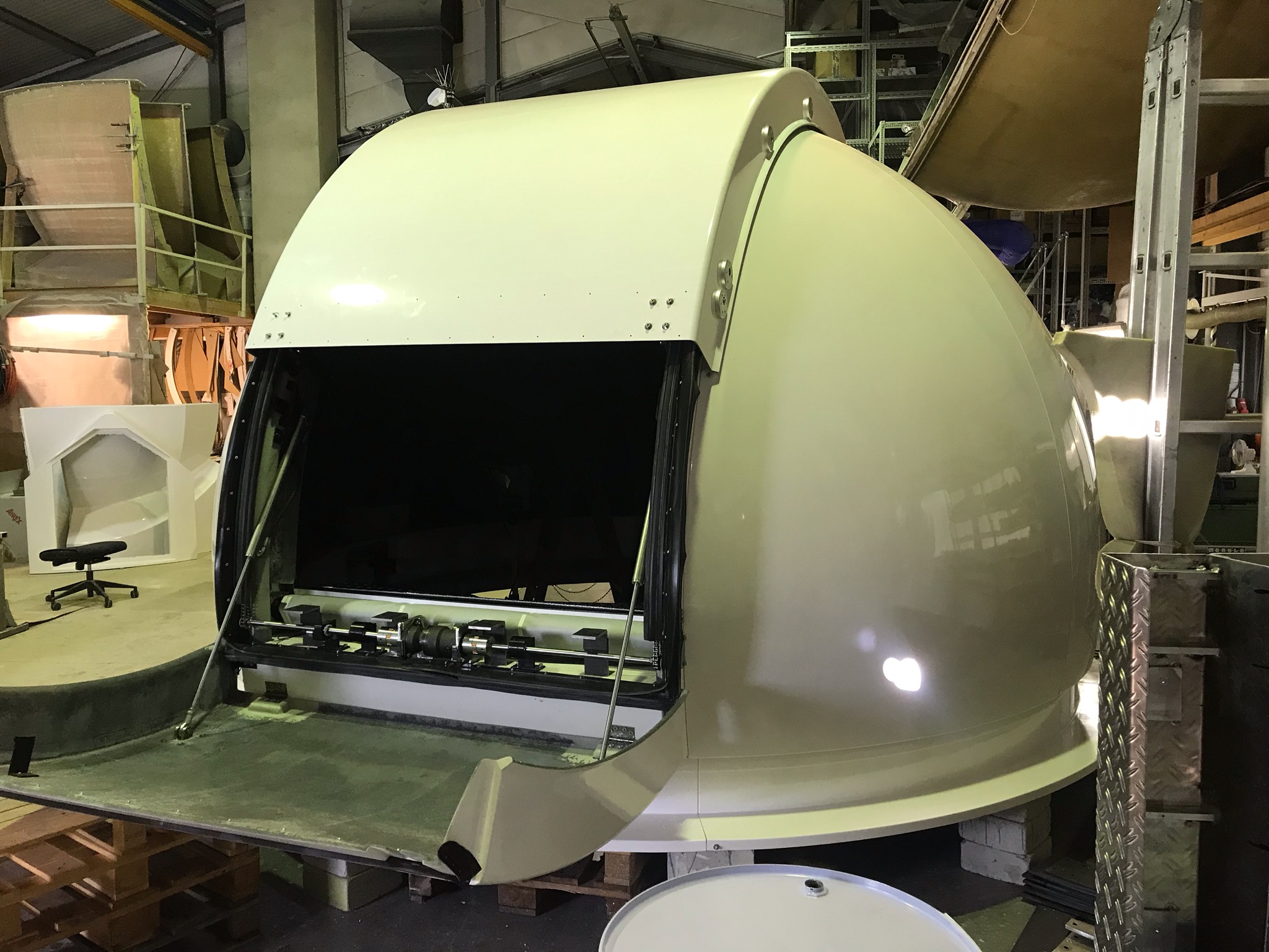
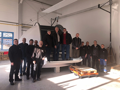
- Dome Factory Acceptance Test (FAT) at MGO successfully completed
Release Date: 09/30/2019
The MGO dome
The MGO dome successfully passed the Factory Acceptance Test (FAT) at Baader Planetarium in Mammendorf Germany on September 19, 2019. Scott Wetzel (KBR) and Julie Horvath (KBR) were in attendance. They approved the FAT and accepted the dome. Installation of the dome at MGO is expected to occur in January 2020.
 Lightning strikes the McDonald Laser Ranging Station (MLRS) in Texas
Release Date: 09/30/2019 Lightning struck the McDonald Laser Ranging Station (MLRS) in Texas on September 12, 2019 rendering it inoperable. The SGP is currently building a next generation SGSLR station next to the MLRS, and has decided to not repair the 37-year-old MLRS. The MLRS first started operating in 1982 and quickly became a premiere satellite and lunar laser ranging station. Data from this station was used for the most stringent tests of General Relativity, studies of the interior structure of the moon, and countless other geodetic and spacecraft tracking applications. The SGP looks forward to continuing the legacy of laser ranging from the McDonald Observatory and entering a new chapter with the recently completed VGOS station located just down the hill from the MLRS. Space Geodesy helps track effects of global change
Release Date: 08/28/2019 A new article in the September issue of the Smithsonian's Air & Space magazine describes how space geodesy is tracking the effects of global change down to the millimeter. Several NASA Space Geodesy Project researchers were interviewed for the article including Stephen Merkowitz, Jan McGarry, and Frank Lemoine.
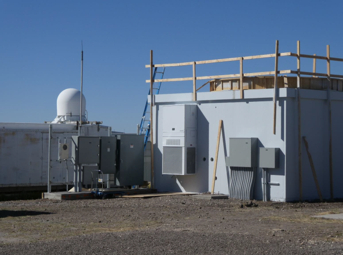
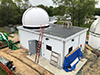
Read the article in Air & Space Magazine.- SGP officially takes ownership of the GGAO SGSLR shelter
Release Date: 08/08/2019 The GGAO SGSLR shelter official inspection took place the morning of Tuesday July 30th. The official punch list for the inside was generated. Participating in this walk through were the Goddard Project Manager for the construction, Quality Assurance, Safety, the Construction team and SGP personnel (Long, McGarry, Donovan and Nelson). After the inspection, SGP officially took ownership of the shelter which is now Goddard building 228. The exterior walk through will occur after the outside stairs are complete.

The shelter from the front on the day before the inspection.
The pier inside the laser room
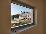
MOBLAS-7 as seen from its new neighbor
- 2019 ILRS Technical Workshop
Release Date: 08/06/2019 The 2019 ILRS Technical Workshop will take place in Stuttgart, Germany, October 21-25. If you plan to attend, please register by August 15 (next Thursday) on the workshop website.
If you have any trouble registering, please send an email to ilrs.workshop@dlr.de.
If you plan to present at the workshop, we ask that you also upload your abstract as soon as possible so we can commence planning the program.
We are looking forward to seeing you all in Stuttgart!
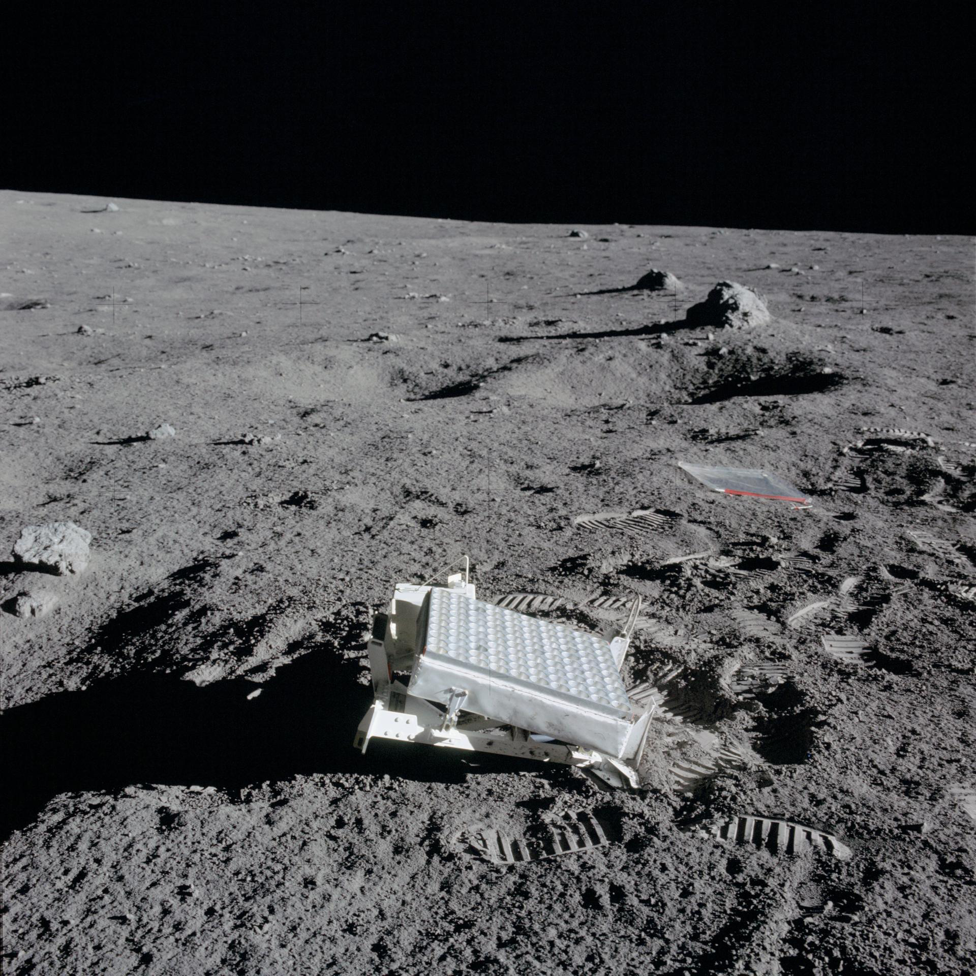
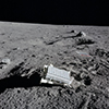 Reflectors placed on the moon by Apollo 11 astronauts 50 years ago continue to provide fresh lunar laser ranging data
Release Date: 07/31/2019 Fifty years ago, Neil Armstrong, Buzz Aldrin and Michael Collins left behind arrays of prisms that reflect light back toward its source; the Apollo 14 and 15 astronauts also did so. Four telescopes at observatories in New Mexico, France, Italy and Germany fire lasers at them, measuring the time that it takes for a laser pulse to bounce off the reflectors and return to Earth. This allows the distance to be measured to within a fraction of an inch (a few millimeters), and scientists at the Jet Propulsion Laboratory analyze the results. Lunar laser ranging measurements have deepened our understanding of the dance between the Moon and Earth.
Read more about reflectors on the moon...
 Michael Lefebvre, French pioneer and major actor in satellite geodesy, passes away
Release Date: 07/26/2019Michel Lefebvre has passed away at his home on July 21, 2019 after a long illness.
He was one of the French pioneers and a major actor in satellite geodesy.
He contributed enormously to training the researchers and engineers of today in this discipline, at the time of the formation of GRGS (Groupe de Recherche de Geodesie Spatiale), which resulted from the cooperation of research teams at CNES (Michele’s team), Meudon Observatory and others. This was also the time of international satellite observing campaigns (ISAGEX, Trapol, Medoc, etc.) in which Michel was deeply involved.
Michel always was eager to debate on new ideas, his energy and enthusiasm were incredible, which were essential to the development of our projects and our works over fifty years, also to the rising of vocations in our field. He had a strong charisma, though a warm personality, respectful of everyone’s viewpoint. His constructive spirit and creativity were striking and he was carefully listened to within national (CNES, GRGS, Bureau des Longitudes) and international (NASA, DLR, ESA) organizations.
As a leading expert, he had a prominent and determining role in the realization of the first satellite altimetry missions, especially TOPEX-Poseidon. Michel set the stage for the creation of the Laboratoire d’Etude en Geophysique et Oceanographie Spatiale (LEGOS), and had decisive actions in changing the French oceanographic community. He established the Club of Argonauts, in which oceanographers and climatologists discuss scientific and societal aspects of climate change. He also was at the origin of GODAE (Global Ocean Data Assimilation Experiment) and of Mercator Ocean (the French center for ocean predictions and analysis).
Michel has left his mark on many young people who started their career with him. They went their own way but kept good and fruitful relationship with him. His death brings back lots of memories to all of us. A strong personality has left us.
Our thoughts are with his wife Claude and their children and grandchildren.
- Journal of Geodesy Special Issue on Laser Ranging
Release Date: 07/23/2019 The following peer-reviewed Journal of Geodesy articles were recently published online at the journal site. These are all part of the Special Issue on Laser Ranging which is preparation. Several more articles are in the review process and upon completion the printed version will be published.
 Shooting for the stars
Release Date: 07/23/2019 Photographer Mogens Johansen visited Yarragadee and gives some practical tips on capturing the geodetic instruments against the night sky.
 Results of The National Geodetic Survey's local tie survey at the NSGN Haleakala site posted
06/18/2019The National Geodetic Survey posted the results of their local tie survey at the NSGN Haleakala site on Maui, Hawaii. Vectors were measured between the SLR and GNSS station and ground marks to support the International Terrestrial Reference Frame and NGS's Foundation CORS program. The survey results, report, and SINEX file are available at the NGS website.
- SGP Project Manager Stephen Merkowitz interviewed by TVPerú
05/31/2019SGP Project Manager Stephen Merkowitz was interviewed by TVPerú in Spanish for a story on the NASA Satellite Laser Ranging Station TLRS-3 in Arequipa, Peru that aired on TVPerú Noticias. A version of the story was also aired in Quechua: https://youtu.be/wNyjMAAhS7M
- 2019 ILRS Technical Workshop first circular released
05/13/2019The first circular for the 2019 ILRS Technical Workshop has been released. The workshop will take place October 21-25 in Stuttgart, Germany.
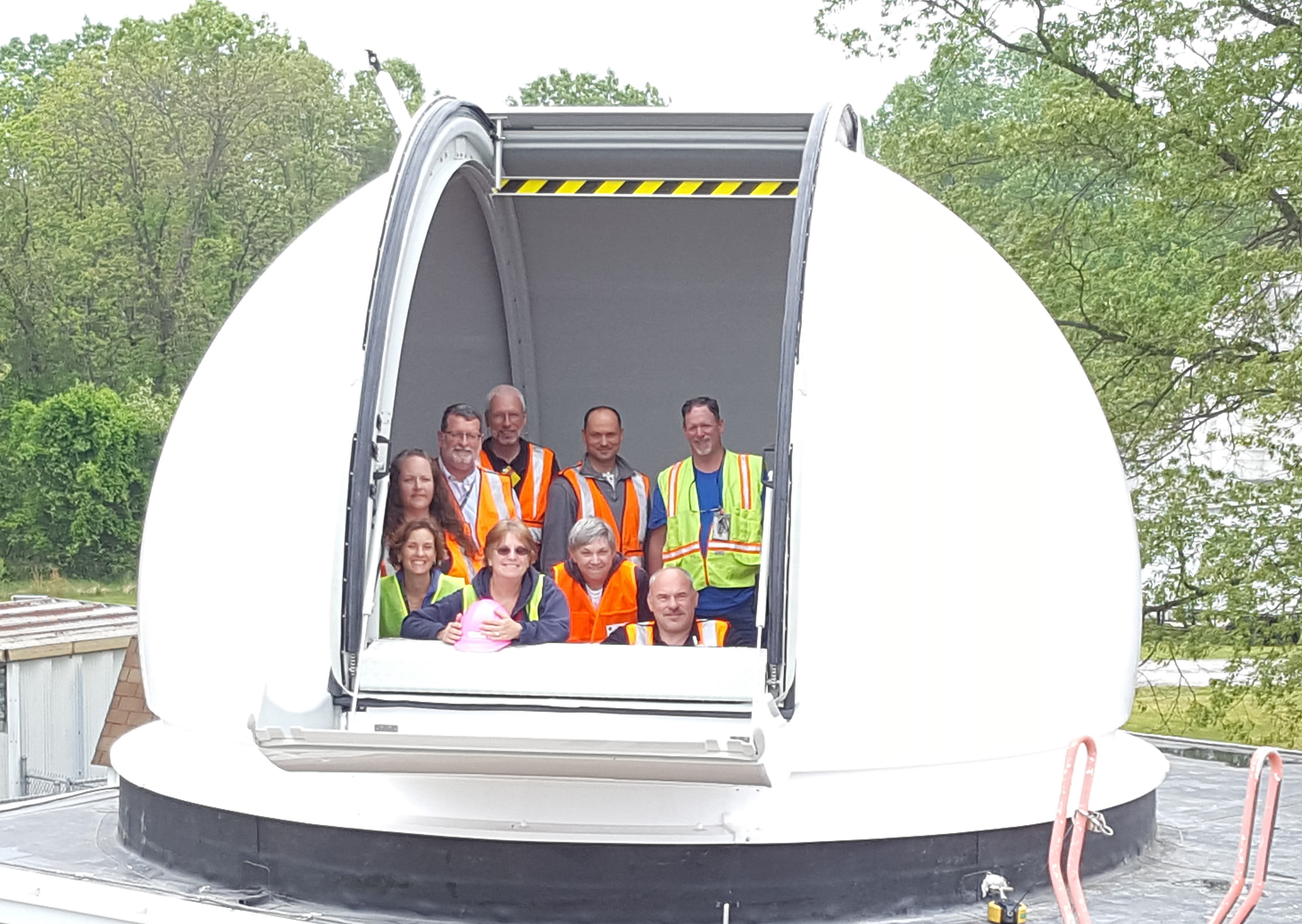
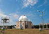
 Site Acceptance Test (SAT) for SGSLR Dome @ GGAO Successful
05/06/2019The dome Site Acceptance Test (SAT) was performed Friday morning May 3rd and it was successful. Here is a team picture of the Baader and SGSLR teams in the dome after the successful SAT.
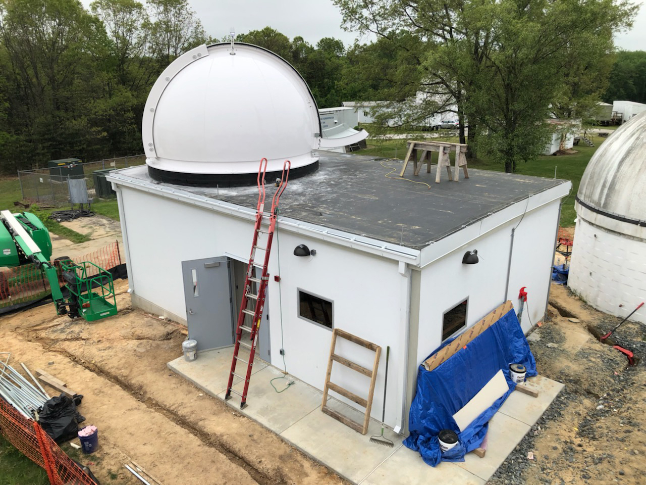
 Dome for the SGSLR shelter at GGAO installed
05/02/2019The dome for the new SGSLR shelter building at GGAO was assembled by the Baader Planetarium team in the GGAO parking lot. Once the dome was built, on May 1st a crane arrived to perform the lifting. The dome ring, followed by the dome itself, were lifted and installed on the roof.
The shelter before the dome was installed

The shelter after the dome was installed
 Progress on the shelter and arrival of the dome parts at GGAO
04/22/2019The shelter continues to progress. The doors and windows are taking shape and the roof is being worked.
The sea container with the dome parts arrived at the port of Baltimore from Germany on April 15th and was delivered to GGAO the morning of April 18th. There was a great deal of excitement at GGAO when it arrived and a lot of the site construction and SGSLR teams were there to greet it. A large forklift was required to remove it from the truck as it weighs over 5000 lbs. It is currently resting just North of NGSLR, waiting for the Baader team to arrive and assemble the parts and then install the dome on the shelter.

The shelter under construction
The freight container with the dome parts
 Jan McGarry gives SGSLR presentation to GSFC Astronomy Club
04/09/2019Jan McGarry, NASA GSFC, gave a presentation to the GSFC Astronomy Club on April 09, 2019 highlighting the initial development and testing of the SGSLR system at Goddard’s Geophysical and Astronomical Observatory (GGAO). The talk also included background on SLR and NASA’s legacy SLR network, as well as the ILRS and SGP and future plans for the global deployment of SGSLR systems.
 Commercial power to TLRS-4 at Haleakala restored
03/14/2019A winter storm damaged commercial power transmission lines to the observatories on Haleakala, Hawaii, USA on February 10, 2019. Commercial power to TLRS-4 at Haleakala has been restored.
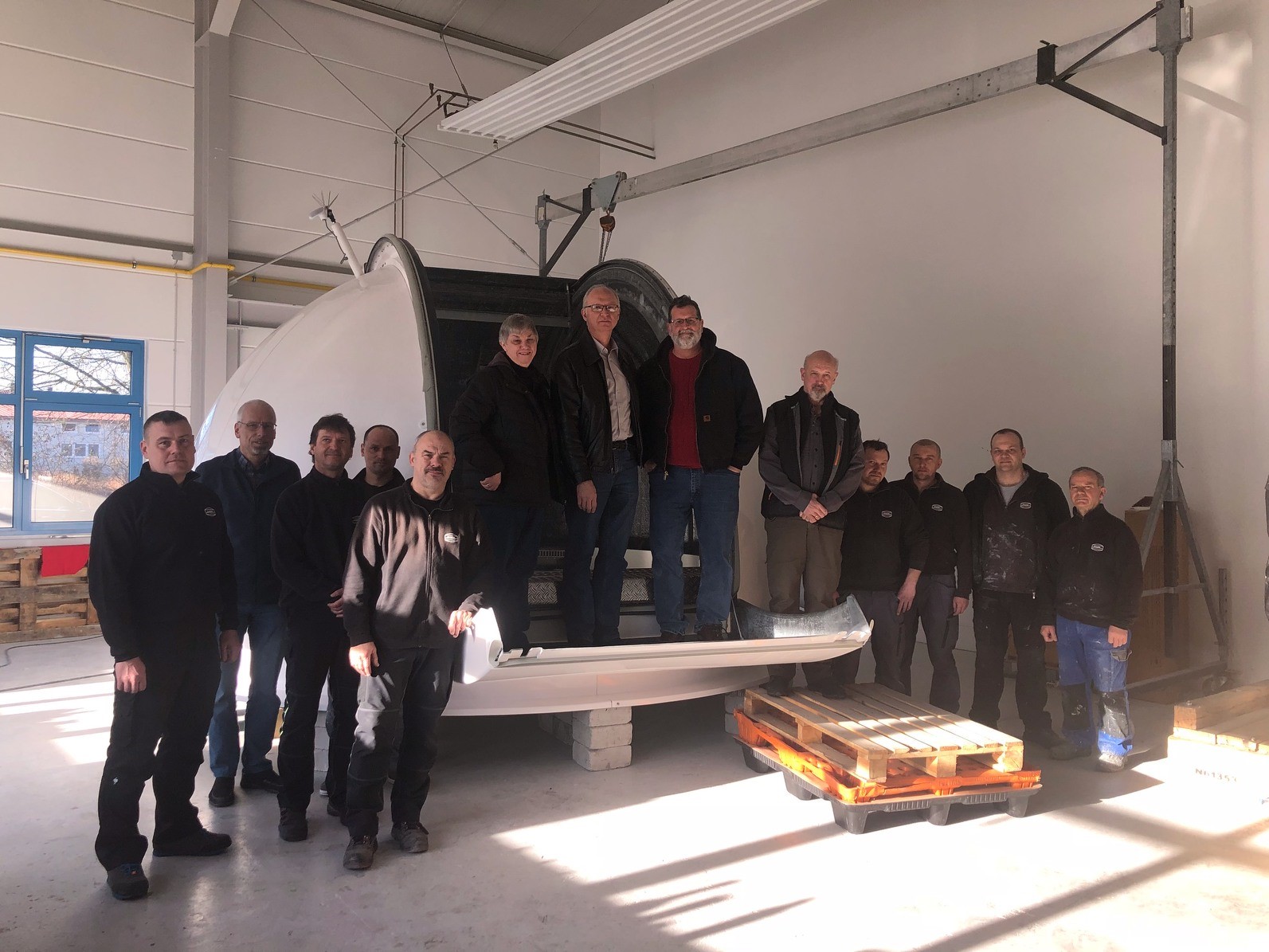
- The SGSLR dome for the new system at GGAO passes Factory Acceptance Testing (FAT)
03/06/2019The SGSLR dome passed Factory Acceptance Testing (FAT) on March 5th at the Baader Planetarium factory outside of Munich Germany. The Baader development team and the three members of the SGSLR team who were at Baader’s facility for the FAT took time the following day for a group photo with the SGSLR dome. This is the dome that will be delivered to GGAO sit on top of the shelter.
Standing on the dome flap are McGarry, Donovan and Wetzel. Just to the right of the dome is Thomas Baader.
Watch the SGSLR dome in action below.
© Baader Planetarium, Munich, Germany
- The GGAO shelter for the new SGSLR goes up in an all-day-long activity
03/05/2019The shelter goes up in an all-day-long activity. The sun is setting as the roof is finally lowered onto the building by crane. MOBLAS-7 can be seen in the left foreground of the picture.
The SGSLR shelter after installation. The building is together but clearly needs a lot of finishing work including adding the door and windows and the interior build out.
The roof is lowered onto the building
Installed shelter
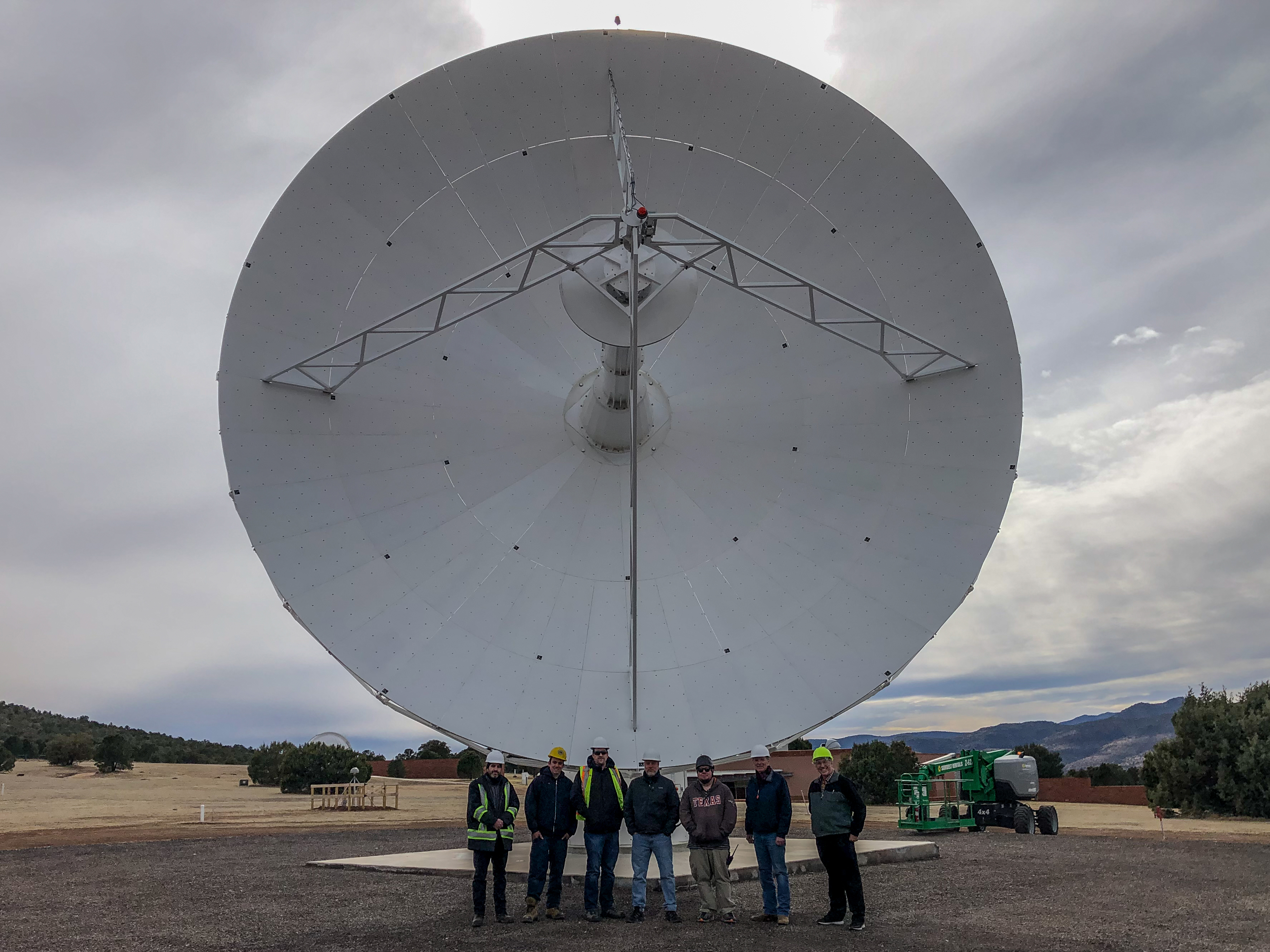
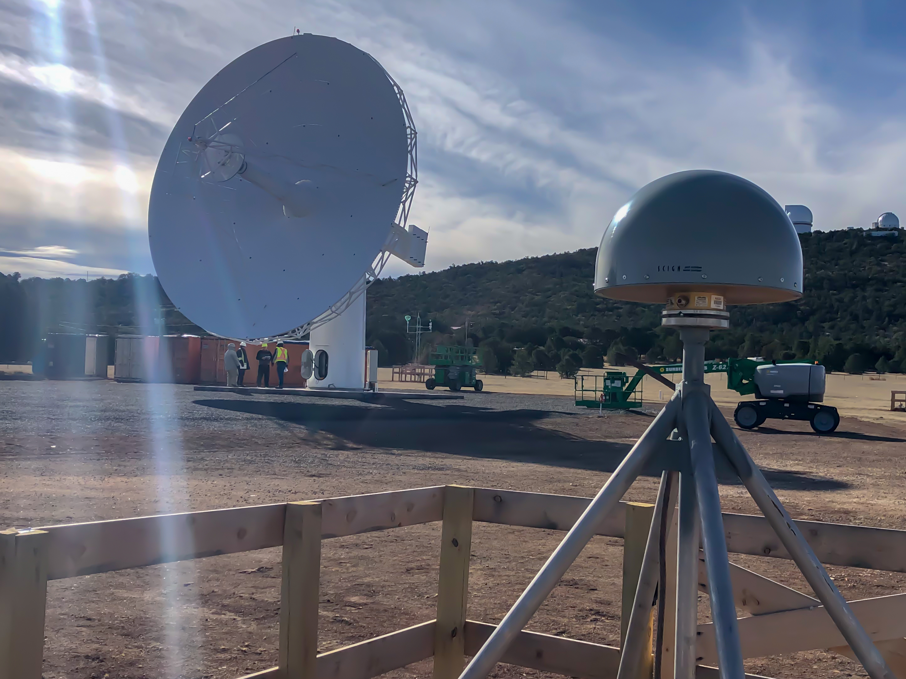
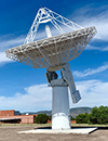
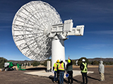
 New MGO VLBI Antenna Passes Site Acceptance Test
02/26/2019Intertronic Solutions Inc. completed the installation of the Space Geodesy Project’s new 12-meter VLBI antenna at the McDonald Observatory in Texas. An engineering room-temperature feed, developed and installed by MIT Haystack, was used to support the pointing tests. On February 15, 2019 several extragalactic sources were observed and the antenna successfully passed the Site Acceptance Test (SAT) on February 20, 2019. The MIT Haystack-developed cryogenic broadband signal chain will be installed in April after which the station will be ready to begin commissioning and participating in VGOS test sessions.

DORIS antenna in the foreground with VLBI antenna in the background
The rear side of the VLBI antenna on its mount
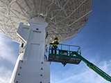
The underside of the VLBI antenna with a person in a lift near the top
 The concrete pad for the shelter for the new SGSLR system at GGAO has been poured
02/20/2019With the Government Shutdown now over, the pad has been poured. MOBLAS-7 is in the background with the telescope in the left most of the three trailers and the aircraft avoidance radar sits atop the center trailer.
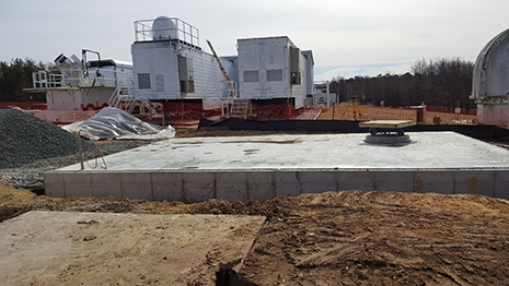
The concrete pad for the shelter for the new SGSLR system has been poured
- TLRS-4 at Haleakala without power
02/19/2019A winter storm damaged commercial power transmission lines to the observatories on Haleakala, Hawaii, USA. Since February 10, TLRS-4 has been without power.
The local electric power company estimates repair to take a minimum of 4 weeks and as long as 8 weeks. The team is exploring ways to power the site with a backup generator or by connecting to a nearby observatory that has backup power.
 Planning for the 2019 ILRS Technical Workshop has begun
02/12/2019Planning for the 2019 ILRS Technical Workshop has begun! We ask that you mark your calendars and reserve the date for the next gathering of the ILRS community:
Dates: October 21-25, 2019
Location: Stuttgart, GermanyThe workshop will be sponsored by the DLR in Stuttgart, Germany. The program committee is actively working on the defining the theme and session topics for the workshop while the local organizers are planning the workshop logistics.
The first circular for the workshop will be issued in the very near future.
We hope you will consider attending the workshop!
 Lunar Laser Ranging featured on the "Today" show
02/11/2019NBC Sunday Today recently reported on lunar laser ranging activities at the APOLLO system in Sunspot NM.
 The Passing of Richard Biancale
02/08/2019It is with profound sadness that we must announce to you the passing our colleague, Dr. Richard Biancale, geodesist, recently retired from the CNES in September 2018, and most recently working at the GFZ (Oberpfaffenhofen) with Dr. Frank Flechtner on GRACE Follow-On. We were informed of his death on Monday February 4, 2019 from a heart attack while skiing in the Alps.
Richard had a long and distinguished career in Space Geodesy. He received his Ph.D. in 1978 from the University Pierre and Marie Curie in Paris (France) while working under Professor Cristoph Reigber at the Technical University of Munich (Germany). He worked as a research scientist at the University of São Paulo, at the DGFI (Deutsches Geodãtisches Forschungsinstitut) in Munich (Germany), and at CERGA (Centre d'Etudes et de Recherches en Géodynamique et Astronométrie) Grasse (France), before joining the French Space Agency, the CNES (Toulouse, France) in 1982 as a scientific engineer.
Under the direction of Michel Lefebvre, one of his first jobs at the CNES was to define the DORIS tracking system for the TOPEX/Poseidon mission. Since 1984, he was very involved in the French-German cooperation on gravity field modeling, first with the GRIM models, and then with the EIGEN models after the launches of CHAMP and GRACE. He served as the scientific manager of the Stella laser geodetic satellite, launched in 1993. Under the direction of Dr. Georges Balmino, he became chief of the "Terrestrial and Planetary Geodetic Department" of the CNES in 1992. He received his "Habilitation" in 2006 and, starting in 2008, served as Executive Director of the Groupe de Recherche de Géodésie Spatiale (GRGS), a French national group that gathers 120 researchers from organizations involved in Space Geodesy studies.
Over the course of his career he has supervised and inspired more than a dozen Ph.D students and served as a mentor to many colleagues and young scientists. Understanding the importance of training the next generation of scientists in satellite geodesy, he has taught geodesy for over 25 years at engineer schools (e.g. ENSG [École de la Géomatique/National School of Geographic Sciences], ENSTA [École Nationale Supérieure de Techniques Avancées]), at universities (e.g. Paris VI), and short training courses (e.g. GRGS Summer School).
Throughout his career he has worked assiduously to improve the quality of geodetic data, and to advance the science obtained from these data. He was a strong proponent of the need for improving the International Terrestrial Reference Frame (ITRF), supporting the contributions to the IDS, IGS, ILRS, IVS and IERS. He has participated and led national and international proposals for new innovative space missions that would continue to advance the contribution of geodesy to science and society. Most recently, before and after his retirement from CNES, he worked to advance the proposal for the Tahiti Geodetic Observatory, a fundamental station including VLBI, SLR, GNSS and DORIS whose geographic location would be of prime importance to the ITRF and to the mm-level goals of the Global Geodetic Observing System (GGOS) in the next decade.
As many of his colleagues noticed, Richard Biancale had a joie de vivre. He was a charming, free, passionate and cheerful man who embraced life whether it was in a fine restaurant after a scientific meeting, sailing around the Mediterranean or across the Atlantic on his catamaran, "RaphyO2", or visiting interesting cultural or natural locales. As his colleagues, we were all privileged to enjoy his friendship. We lament this tragic loss.
To his family, including wife, Irmtraud, and four children, Raphaël, Philipp, Johannes & Jocelyne, we extend our deepest sympathy and most heartfelt condolences.
Frank Lemoine
(NASA Goddard Space Flight Center, Greenbelt, Maryland, U.S.A)Laurent Soudarin
(Collecte Localisation Satellites, Ramonvile-Saint Agne, FRANCE)Jean-Michel Lemoine & Pascale Ferrage(Centre Nationale d' Études Spatiales, Toulouse, FRANCE)Jean-Paul Boy
(EOST, University of Strasbourg, Strasbourg, FRANCE)
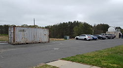
 SGSLR on Mt Fowlkes at MGO starts with pad and pier
01/12/2019The SGSLR pad and pier at MGO were completed in January 2019. The electrical panels were temporarily placed on one side of the pad until the shelter could be installed.
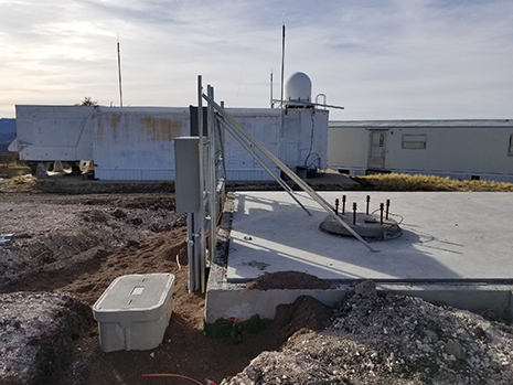
The SGSLR pad and pier at MGO