

2014 Project News
 Earthdata Article Featuring CDDIS PublishedRelease Date: 12/04/2014
Like many physicists today, Rafael Lang at Purdue University is on the hunt. As in a treasure hunt, the odds of finding the treasure may be slim, but the rewards are huge and the lure of the hunt irresistible. Lang said, "If we were to find something, it would be super, super exciting, another puzzle piece to open this new world."
Earthdata Article Featuring CDDIS PublishedRelease Date: 12/04/2014
Like many physicists today, Rafael Lang at Purdue University is on the hunt. As in a treasure hunt, the odds of finding the treasure may be slim, but the rewards are huge and the lure of the hunt irresistible. Lang said, "If we were to find something, it would be super, super exciting, another puzzle piece to open this new world."
 Read more
  19th International Workshop on Laser Ranging a great successRelease Date: 11/18/2014
The 19th International Laser Ranging Workshop was hosted by NASA GSFC from October 27-31, 2014 in Annapolis, Maryland. October 31 marks the 50th anniversary of the first successful Satellite Laser Ranging (SLR) measurement which occurred at the Goddard Geophysical and Astronomical Observatory (GGAO) in 1964. The theme for this workshop, "Celebrating 50 Years of SLR: Remembering the Past and Planning for the Future" allowed the community to look back on its many accomplishments and to present plans for future advances in SLR technology and science. Sponsors for the Workshop were NASA, the Smithsonian Astrophysical Observatory (SAO), and the International Laser Ranging Service (ILRS). The Workshop was organized by Carey Noll (NASA GSFC, CDDIS DAAC Manager), Jan McGarry (NASA GSFC), Mike Pearlman (SAO) and Stephen Merkowitz (NASA GSFC) and was attended by approximately 180 participants from 25 countries.
19th International Workshop on Laser Ranging a great successRelease Date: 11/18/2014
The 19th International Laser Ranging Workshop was hosted by NASA GSFC from October 27-31, 2014 in Annapolis, Maryland. October 31 marks the 50th anniversary of the first successful Satellite Laser Ranging (SLR) measurement which occurred at the Goddard Geophysical and Astronomical Observatory (GGAO) in 1964. The theme for this workshop, "Celebrating 50 Years of SLR: Remembering the Past and Planning for the Future" allowed the community to look back on its many accomplishments and to present plans for future advances in SLR technology and science. Sponsors for the Workshop were NASA, the Smithsonian Astrophysical Observatory (SAO), and the International Laser Ranging Service (ILRS). The Workshop was organized by Carey Noll (NASA GSFC, CDDIS DAAC Manager), Jan McGarry (NASA GSFC), Mike Pearlman (SAO) and Stephen Merkowitz (NASA GSFC) and was attended by approximately 180 participants from 25 countries.
On Monday, the history of SLR was given in a series of six invited talks by the pioneers in the field. The afternoon was devoted to invited science talks showing SLR's positive impact on various NASA and international missions.
In addition to the events in Annapolis, the participants were given a day-long tour of GSFC and GGAO, including tours of the Goddard Visitor's Center, Building 7 Integration and Testing facilities, Building 29 James Webb Space Telescope (JWST) integration and testing, and tours of the NASA next generation space geodesy systems at GGAO. A Goddard Joint Engineering and Scientific Colloquium on Wednesday featured a seminar by John Degnan, "A Celebration of Fifty Years of Satellite Laser Ranging." John's talk was introduced with a few words from GSFC Center Director, Chris Scolese.
A new format for a station operations session was introduced at this workshop where ILRS experts met in small groups of station engineers and operators to provide solutions to common station problems, information to maintain station stability, and guidelines for interacting with the analysts in determining station biases. These station clinics were well attended and received by workshop attendees.
A highlight of the Workshop was a speech and question and answer session at Thursday evening's banquet given by Dr. Piers Sellers, GSFC Deputy Director of the Sciences and Exploration Directorate and NASA astronaut.
There were 81 oral presentations and 70+ posters at the Workshop. The Goddard participants were authors or co-authors of over 30 of these, with many highlighting the new Space Geodesy Satellite Laser Ranging (SGSLR) Systems and the Next Generation Space Geodesy Network. SGSLR and the Space Geodesy Network will be built by Space Geodesy Project at Goddard for global deployment over the coming decade.
This workshop in Annapolis and GSFC proved to be a very successful gathering of international experts in the field of satellite laser ranging. The workshop website (https://cddis.gsfc.nasa.gov/lw19) will soon be updated with presentations, posters, summaries, and photos from the week.-
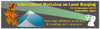
19th International Workshop on Laser Ranging - Celebrating 50 years of SLRRelease Date: 09/24/2014
The National Aeronautics and Space Administration (NASA), along with the Smithsonian Astrophysical Observatory, and the International Laser Ranging Service (ILRS), are pleased to announce that the 19th International Workshop on Laser Ranging will be held in Annapolis Maryland during the week of October 27-31, 2014 at the Historic Inns of Annapolis.
October 31, 2014 will mark the 50th anniversary of the first successful SLR measurement, conducted at what is now the Goddard Geophysical and Astronomical Observatory (GGAO). The theme for this workshop, "Celebrating 50 Years of SLR: Remembering the Past and Planning for the Future" will allow us to look back on our many accomplishments and present plans for future advances in SLR technology and science.
Visit the workshopp web site 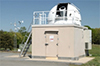 Celebrating 50 Years of Satellite Laser Ranging at NASA Goddard Space Flight CenterRelease Date: 08/28/2014
We like to think of Earth as a big blue marble; a shimmering, smooth sphere. In reality, our home planet is shaped more like a big blue potato (or, to be polite and more scientific, an "oblate spheroid"). The combination of Earth’s rotation at roughly 1,670 kilometers per hour, the uneven distribution of continents that are slowly moving, the Moon’s tug on tides, ocean circulation, and a host of other factors cause our planet to have an uneven surface that is a bit flat at the poles and slightly bulging around the middle.
Celebrating 50 Years of Satellite Laser Ranging at NASA Goddard Space Flight CenterRelease Date: 08/28/2014
We like to think of Earth as a big blue marble; a shimmering, smooth sphere. In reality, our home planet is shaped more like a big blue potato (or, to be polite and more scientific, an "oblate spheroid"). The combination of Earth’s rotation at roughly 1,670 kilometers per hour, the uneven distribution of continents that are slowly moving, the Moon’s tug on tides, ocean circulation, and a host of other factors cause our planet to have an uneven surface that is a bit flat at the poles and slightly bulging around the middle.
This means that the Earth’s exact shape, center of gravity, and precise rotation are constantly changing and can only be determined through extremely precise measurements. An entire field of science called geodesy is devoted to taking these precise measurements, and Goddard Space Flight Center is at the leading edge of this field. In fact, it was in a field near Goddard 50 years ago this October that the first successful Satellite Laser Range (SLR) measurements were taken, ushering in a new era in the science of measuring the Earth.
Read more  Ruth Neilan (NASA JPL) appointed to the rank of official U.S. Delegate Advisor for the United Nations to UN Global Geospatial Information Management (GGIM)Slide showRelease Date: 08/26/2014
During the week of August 4-8, Ruth Neilan (NASA JPL) participated in and attended the following meetings at the United Nations in New York, Department of Economic and Social Affairs, UN Statistics Division:
Ruth Neilan (NASA JPL) appointed to the rank of official U.S. Delegate Advisor for the United Nations to UN Global Geospatial Information Management (GGIM)Slide showRelease Date: 08/26/2014
During the week of August 4-8, Ruth Neilan (NASA JPL) participated in and attended the following meetings at the United Nations in New York, Department of Economic and Social Affairs, UN Statistics Division:
- Fourth Session of the United Nations Committee of Experts on Global Geospatial Information Management (UN-GGIM)
- United Nations Global Forum on the Integration of Statistical and Geospatial Information
- Global Geodetic Reference Frame (GGRF) Working Group Meeting
- UN-GGIM regional splinter sessions
Because of her involvement in these critical areas, Ruth has been appointed to the rank of official U.S. Delegate Advisor for the United Nations to UN GGIM.
On August 4-5, a meeting was held on "The Integration of Statistical and Geospatial Information" with significant focus on the Global Geodetic Reference Frame (GGRF). Wednesday, August 6, began with a workshop on the GGRF. The GGRF Working Group is chaired by Australia and Norway (Gary Johnston, Anne Jørgensen and Per Erik Opseth); included in the core working group (WG) are Zuheir Altamimi, Hansjörg Kutterrer, and Ruth Neilan, as key members of the GGRF working group; with larger WG including many country representatives.
The GGRF Working Group tabled a Terms of Reference, a draft UN General Assembly Resolution for the GGRF, and a Concept Note at the 4th Session of the UN Community of Experts on GGIM. After a presentation given by Gary Johnston on August 6, there were 40 extremely positive interventions in support of the work of GGRF – the sheer number of countries formally declaring support for this effort is remarkable and demonstrates that the GGIM's work has had significant impact in the diplomatic sphere.
The draft resolution and its intent were approved by the 77 representative countries. This resulted in an official decision, 4/101, recommending that the amended draft Resolution on a Global Geodetic Reference Frame for Sustainable Development, be referred to the Economic and Social Council for endorsement and further referral to the United Nations General Assembly. The decision also noted the commitment of Member States to provide support in this process.
This resolution, and the tremendous diplomatic and technical effort behind it, highlights the importance of the global geodetic reference frame, its maintenance, upgrade, and collocation of techniques. Additional time was spent in the WG on August 8, laying out the 'GGRF Roadmap' and other supporting strategies. Related documents and information about the GGRF meeting can be found on the web at: http://ggim.un.org/ggim_committee.html
GEO Secretariat, Barb Ryan, was also present at the GGRF workshop and voiced her support of the GGRF on behalf of GEO. In complement to this, Ryan has written a strong support letter for GGRF and will work jointly with the team within the GEO/CEOS committees and the UN GGIM. This will also be a topic at the UN International Committee on GNSS within UN OOSA, which hosted a UN GGIM preparatory meeting this past April in Vienna, Austria.
More information on the GGIM Global Forum, August 4-5 can be found at: http://ggim.un.org/Global%20Forum.html.
Space Geodesy Community Representatives:
- Gary Johnston, Geoscience Australia; Chair of GIAC, Member of the IGS Governing Board
- Per Erik Opseth and Anne Jørgensen, Norwegian Mapping Authority (Kartverket), NASA partners, Ny Alesünd Station
- Zuheir Altamimi, Institut National de l'Information Géographique et Forestière (IGN); ITRF and Member of the IGS Governing Board
- Hansjörg Kutterrer, Bundesamt für Kartographie und Geodäsie (BKG); Chair of GGOS
- Ruth Neilan, NASA JPL; Vice Chair of GGOS, Director of the IGS Central Bureau
 Proceedings from the 18th International Workshop on Laser Ranging Release Date: 03/25/2014
A website for the proceedings from the 18th International Workshop on Laser Ranging, held November 11-15, 2013 in Fujiyoshida Japan, has been created and is now available at https://cddis.gsfc.nasa.gov/lw18/.
Proceedings from the 18th International Workshop on Laser Ranging Release Date: 03/25/2014
A website for the proceedings from the 18th International Workshop on Laser Ranging, held November 11-15, 2013 in Fujiyoshida Japan, has been created and is now available at https://cddis.gsfc.nasa.gov/lw18/.
Because a hardcopy of the proceedings will not be published, all presentations, posters, and papers collected thus far have been made available through this website. Session summaries and ILRS splinter meeting notes are also linked on the website. The ILRS would like to acknowledge the significant, and thorough, efforts of the program committee in working with workshop participants to collect the documents that are now available through the website. New CDDIS website now availableRelease Date: 03/24/2014
The CDDIS staff is pleased to announce a new CDDIS website is now available. This redesign has allowed for a review of the organization of the site and its contents, ensuring information is current and useful. The new site also incorporates an improved navigation scheme. The website features access to applications enabling data discovery. One application, the SiteLogViewer, provides an enhanced display and comparison of the contents of ILRS and IDS site logs used by the services to document a site's system configuration; IGS and IVS site logs will be added to the utility in the near future.
New CDDIS website now availableRelease Date: 03/24/2014
The CDDIS staff is pleased to announce a new CDDIS website is now available. This redesign has allowed for a review of the organization of the site and its contents, ensuring information is current and useful. The new site also incorporates an improved navigation scheme. The website features access to applications enabling data discovery. One application, the SiteLogViewer, provides an enhanced display and comparison of the contents of ILRS and IDS site logs used by the services to document a site's system configuration; IGS and IVS site logs will be added to the utility in the near future.
Comments and suggestions are welcome and should be directed to the CDDIS support group through the "Contact Us" link. We would like to acknowledge the efforts of the website development team (Lori Tyahla, Nathan Pollack, and Carey Noll) for their contributions to the site content. Robert H. Goddard Award RecipientsRelease Date: 03/18/2014
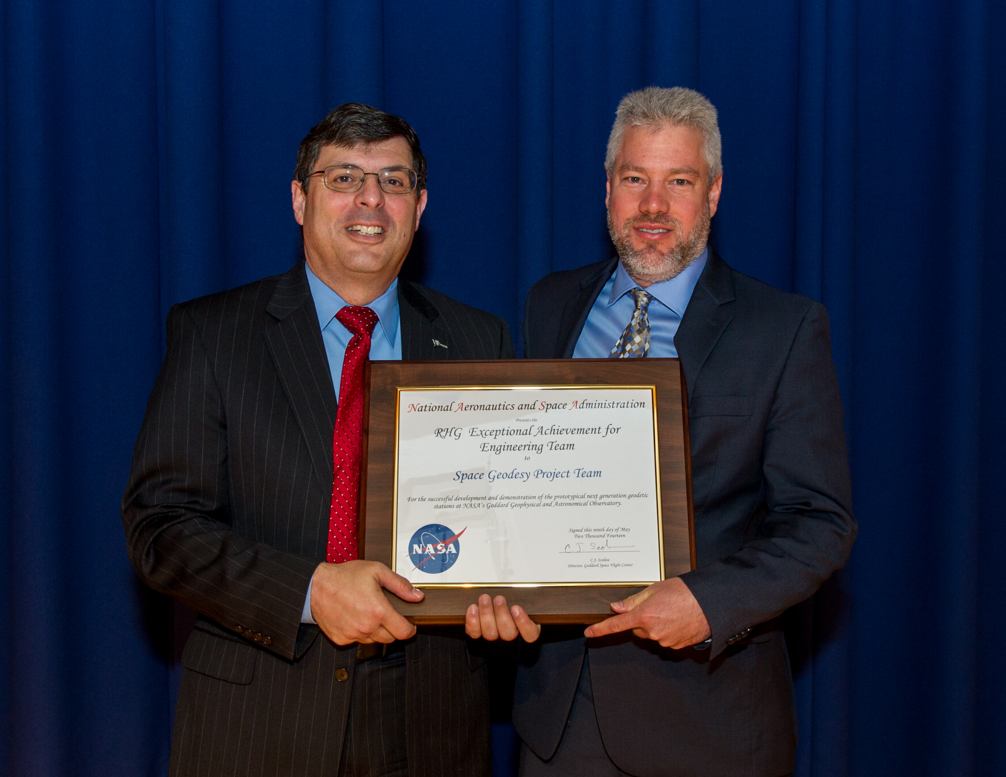
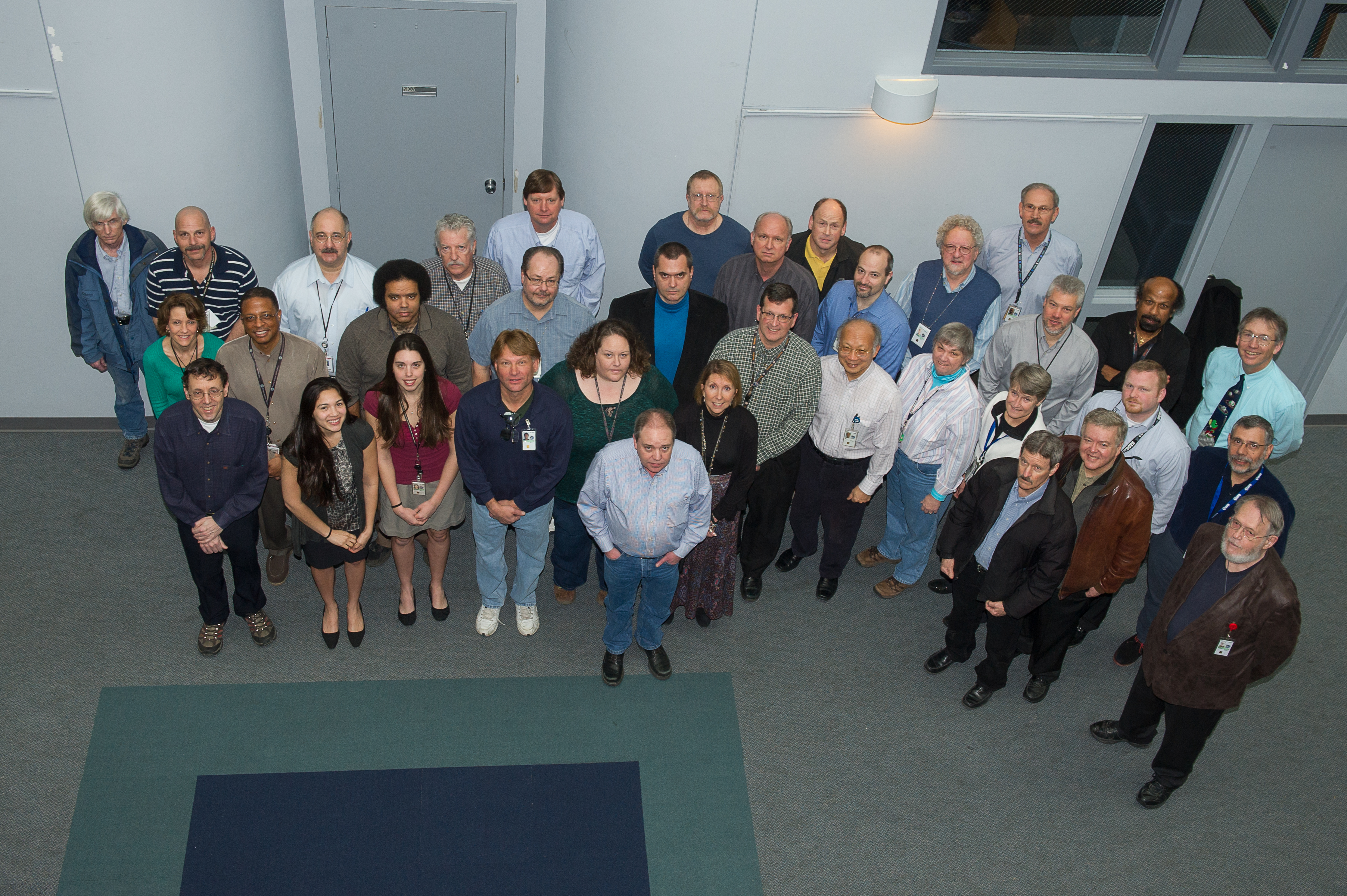
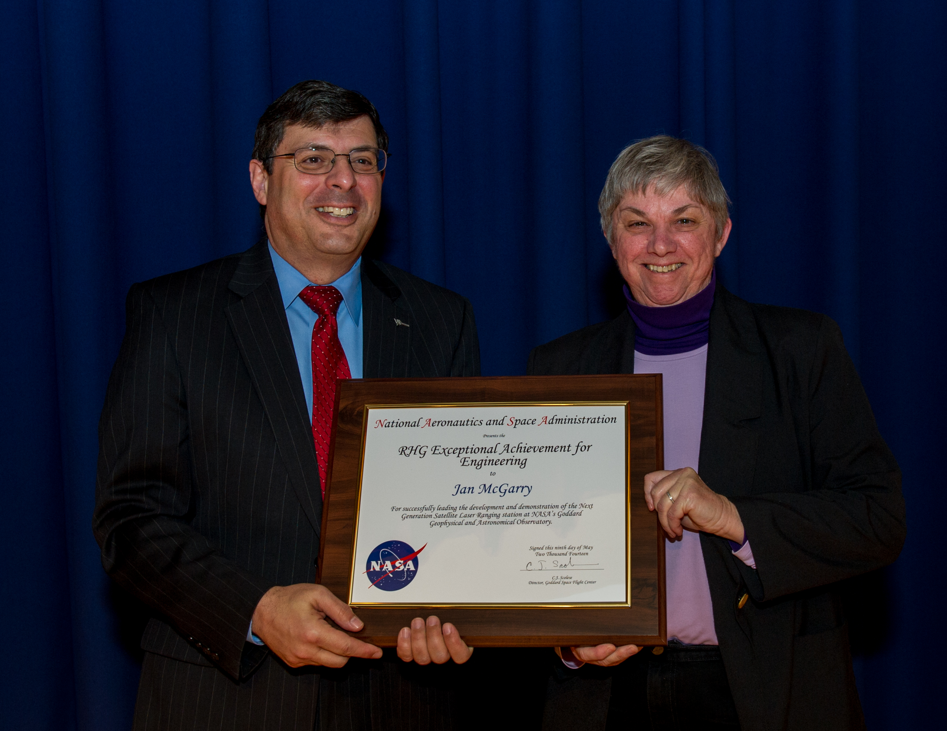
Congratulations to the Space Geodesy Project Team for receiving the Robert H. Goddard Exceptional Achievement Group Award for Engineering (group photos GSFC | MIT). Additional congratulations goes to Jan McGarry, who received an individual Robert H. Goddard Award for Exceptional Engineering Achievement.
Robert H. Goddard Award RecipientsRelease Date: 03/18/2014
Congratulations to the Space Geodesy Project Team for receiving the Robert H. Goddard Exceptional Achievement Group Award for Engineering (group photos GSFC | MIT). Additional congratulations goes to Jan McGarry, who received an individual Robert H. Goddard Award for Exceptional Engineering Achievement.  Network outage - Saturday, March 15, 2014 from 08:00 a.m. through 04:00 p.m. EDT (12:00-20:00 UTC) Release Date: 03/07/2014
We have been notified that there will be a network outage (due to work on NASA's backbone equipment) on Saturday, March 15, 2014 from 08:00 a.m. through 04:00 p.m. EDT (12:00-20:00 UTC). Unfortunately, this activity will affect CDDIS operations. All connectivity to our servers will be off-line during that time. The outage will also affect access to the CDDIS, ILRS, LRO-LR, and Space Geodesy Project websites.
Network outage - Saturday, March 15, 2014 from 08:00 a.m. through 04:00 p.m. EDT (12:00-20:00 UTC) Release Date: 03/07/2014
We have been notified that there will be a network outage (due to work on NASA's backbone equipment) on Saturday, March 15, 2014 from 08:00 a.m. through 04:00 p.m. EDT (12:00-20:00 UTC). Unfortunately, this activity will affect CDDIS operations. All connectivity to our servers will be off-line during that time. The outage will also affect access to the CDDIS, ILRS, LRO-LR, and Space Geodesy Project websites.
While the CDDIS is unavailable, users can access one of the other data centers supporting the services:
- IGS: https://igs.org/data-access/#global-dcs
- ILRS: https://ilrs.gsfc.nasa.gov/data_and_products/data_centers/index.html
- IVS: http://ivscc.gsfc.nasa.gov/about/org/components/dc-list.html
- IDS: http://ids-doris.org/data-products/info.html
We regret the inconvenience the outage will cause our user community. NASA Solar System Exploration Division Seminar Release Date: 01/29/2014
An SSED seminar will be held Monday, February 10 from 2 to 3 p.m. in Building 34, Room W150. The speaker, Dr. Zuheir Altamimi from IGN in France, will give a presentation entitled "The International Terrestrial Reference Frame: current status and future challenges."
19th International Workshop on Laser Ranging AnnouncedRelease Date: 01/21/2014
We are pleased to announce that the 19th International Workshop on Laser Ranging will be hosted at NASA Goddard Space Flight Center, October 27-31 2014. Goddard has the unique opportunity to host this event at the birthplace of SLR: October 31, 2014 will mark the 50th anniversary of the first SLR measurement, conducted at what is now the Goddard Geophysical and Astronomical Observatory, GGAO. The theme for this workshop, "Celebrating 50 Years of SLR: Remembering the Past and Planning for the Future" will allow us to look back on our many accomplishments and present plans for future advances in the SLR technique. Furthermore, we solicit contributions from complementary space geodesy techniques and from activities that rely on the integration of SLR with other space geodesy techniques.
NASA Solar System Exploration Division Seminar Release Date: 01/29/2014
An SSED seminar will be held Monday, February 10 from 2 to 3 p.m. in Building 34, Room W150. The speaker, Dr. Zuheir Altamimi from IGN in France, will give a presentation entitled "The International Terrestrial Reference Frame: current status and future challenges."
19th International Workshop on Laser Ranging AnnouncedRelease Date: 01/21/2014
We are pleased to announce that the 19th International Workshop on Laser Ranging will be hosted at NASA Goddard Space Flight Center, October 27-31 2014. Goddard has the unique opportunity to host this event at the birthplace of SLR: October 31, 2014 will mark the 50th anniversary of the first SLR measurement, conducted at what is now the Goddard Geophysical and Astronomical Observatory, GGAO. The theme for this workshop, "Celebrating 50 Years of SLR: Remembering the Past and Planning for the Future" will allow us to look back on our many accomplishments and present plans for future advances in the SLR technique. Furthermore, we solicit contributions from complementary space geodesy techniques and from activities that rely on the integration of SLR with other space geodesy techniques.
Please consider participation in this workshop and reserve the week to join us at NASA GSFC. More details will be provided shortly.
