


The Navy and NASA are jointly preparing an Environmental Impact Statement (EIS) for real estate agreements at PMRF and KPGO
June 20, 2025
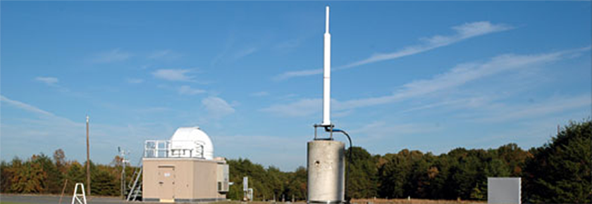
 The U.S. Department of the Navy (Navy) and the National Aeronautics and Space Administration (NASA) have jointly prepared a Draft Environmental Impact Statement (EIS) to evaluate the potential environmental impacts of proposed real estate agreements with the State of Hawai‘i for the Pacific Missile Range Facility (PMRF) and the Kōke‘e Park Geophysical Observatory (KPGO). Public involvement is an integral part of the environmental planning process. The public has an important role in providing input during this process to help the Navy and NASA make more informed decisions about the proposed real estate action including on the environmental impacts of the alternatives, environmental or cultural concerns, information the public would like the Navy and NASA to know, and any other information the public would like to see addressed in the Final EIS.
Between July 15 and July 17, the Navy and NASA will host public meetings at three locations on Kaua‘i. Each meeting will be held from 5 - 8 PM HST and include a live online broadcast and public comment opportunity. Please visit the PRMF & KPGO EIS website to learn more about the real estate action, the environmental planning process, the public meetings or to register for the live online broadcast, or how to submit comments: https://pmrf-kpgo-eis.com/.
GGOS releases short film highlighting the Terrestrial Reference Frame
07/29/2024
 The GGOS (Global Geodetic Observing System) Coordinating Office has now released a new 2.5-minute short film highlighting the critical role of geodetic terrestrial reference frames. This video is primarily aimed at the general public and has been produced in collaboration with the UN-GGCE (United Nations Global Geodetic Center of Excellence). The video is available with subtitles in over 16 languages and can be viewed on the GGOS YouTube channel: https://www.youtube.com/watch?v=zfqq-0d2txk.
This short video complements the more comprehensive 10-minute version ( https://www.youtube.com/watch?v=vvNXv05646M), available in multiple languages, which has been viewed over 40,000 times since its release in September 2023.
New IGS Analysis Center Coordinator Announced
07/24/2024
![]() The International GNSS Service (IGS) Governing Board and Central Bureau have announced that the next IGS Analysis Center Coordinator (ACC) will be a collaborative effort led by the NASA Goddard Space Flight Center and Geoscience Australia, with support from GFZ German Research Centre for Geosciences Potsdam and the Massachusetts Institute of Technology.
The International GNSS Service (IGS) Governing Board and Central Bureau have announced that the next IGS Analysis Center Coordinator (ACC) will be a collaborative effort led by the NASA Goddard Space Flight Center and Geoscience Australia, with support from GFZ German Research Centre for Geosciences Potsdam and the Massachusetts Institute of Technology.
The ACC is a critical role within the IGS, with the following key responsibilities:
- Monitoring the quality of products submitted by individual ACs.
- Combining products from individual ACs to produce robust operational products.
- Evaluating the combined products for performance and consistency.
- Disseminating official IGS combined products through an operational framework.
- Coordinating changes, developments, and improvements within the contributing ACs to use the latest models and standards.
- Evaluating the suitability of new ACs that wish to be recognized by the IGS.
The ACC is responsible for establishing the detailed specifications for IGS products, while working closely with ACs and the IGS Reference Frame Coordinator. Additionally, the ACC works closely with the ACs in the generation of other IGS analysis products, including the content of the IGS ACC website (https://igs.org/acc/). The new NASA/GA+ ACC will undertake a phased approach to ensure a smooth and thorough transition towards a fully multi-GNSS IGS, enhancing the accuracy and reliability of future GNSS products, while working towards achieving the IGS strategic goal of “multi-GNSS Technical Excellence.”
Lockheed Martin receives Laser Retroflector Arrays for GPS III SV9, SV10
07/10/2024
 In partnership with NASA and the National Geospatial-Intelligence Agency, the U.S. Space Force GPS III Program Office has delivered two laser retroflector arrays to Lockheed Martin. On May 6, the LRAs were delivered under a directed program to rapidly integrate hosted payloads on GPS satellites ahead of launch call up. The LRAs will be installed onto two GPS III satellites, SV9 and SV10, in preparation for a 2025 launch.
The addition of the LRA hosted payload onto GPS satellites marks an expansion of NASA’s Space Geodesy Program space instrument network. The GPS III LRAs will allow NASA to make precise range measurements to the sub-centimeter level using the Satellite Laser Ranging technique, enabling accurate determination of the Earth’s center. The NASA Space Geodesy Program and NGA will use collected SLR data from the GPS III LRAs to maintain a globally available, high quality terrestrial reference frame.
Read more on spaceforce.mil...
The Navy and NASA are jointly preparing an Environmental Impact Statement (EIS) for real estate agreements at PMRF and KPGO
05/08/2024
The U.S. Navy and the National Aeronautics and Space Administration (NASA) are jointly preparing an Environmental Impact Statement (EIS) to evaluate the potential environmental impacts of proposed real estate agreements with the State of Hawai‘i for the Pacific Missile Range Facility (PMRF) and the Kōkeʻe Park Geophysical Observatory (KPGO). Public involvement is an integral part of the environmental planning process. The public has an important role in providing input during this process to help the Navy and NASA make more informed decisions about the proposed real estate action including potential alternatives, environmental or cultural concerns, information the public would like the Navy and NASA to know, and any other information the public would like to see addressed in the EIS.
Please visit the PRMF & KPGO EIS website to learn more about the real estate action, the environmental planning process, or how to submit comments: https://pmrf-kpgo-eis.com/.
Complete Dataset from the Apache Point Lunar Laser Ranging Station Released
04/17/2024 In February 2024, NASA published a set of normal points from the Apache Point Lunar Laser Ranging Station to the NASA Crustal Dynamics Data Information System (CDDIS) spanning the entire operations of the station, April 2006 through mid-January 2024. This timespan includes data prior to NASA taking over stewardship of the station that was not previously released in part due to ongoing development of software related to the Absolute Calibration System (ACS) that was installed in late 2016. NASA stewardship of the station helped continue and complete the ACS software development, which prompted a re-processing of all the data to improve its accuracy.
The Navy and NASA are jointly preparing an Environmental Impact Statement (EIS) for state lands at PMRF and KPGO
12/15/2023 The Navy and NASA are jointly preparing an Environmental Impact Statement (EIS) to evaluate the potential impacts of real estate agreements with the State of Hawai'i, Department of Land and Natural Resources (DLNR) for state lands at PMRF and KPGO. The Navy and NASA encourage the public to participate in this environmental review process. The Navy and NASA will be initiating a public scoping period and holding public meetings in early 2024. The public can participate during the public scoping period by providing input on the proposed real estate action and issues to be considered in development of the EIS.
View fact sheet

Using Quasars to Measure the Earth: A Brief History of VLBI
Looking Down a Well: A Brief History of Geodesy