About the Space Geodesy Project
Project Highlights
-
 NASA Forms Space Geodesy Working Group
05/30/2013 NASA has formed the Space Geodesy Working Group to perform fact-finding related to the scientific, technical, and organizational issues associated with the ongoing development of its Space Geodesy Program. The term of service for the Space Geodesy Working Group is three years. The Working Group is tasked to:
- Conduct semi-annual reviews of the Space Geodesy Program to include reviews of the Program's scientific requirements, strategies, and technical approaches; and
- Provide technical findings to NASA on its evaluations of and options for resolving program and project challenges following each semi-annual review.
 Read more
-
 Space Geodesy SLR Request for Information Released
05/02/2013 The National Aeronautics and Space Administration (NASA) Space Geodesy Project (SGP) is soliciting information to improve its understanding of the interest, capabilities, and Rough Order of Magnitude (ROM) estimates for planning the construction, deployment, and operation of the next generation Space Geodesy (SG) Satellite Laser Ranging (SLR) Stations that will be part of a new NASA’s Space Geodetic Network (SGN). NASA is considering the construction of up to ten new SLR stations that will contribute to the larger Global Geodetic Observing System (GGOS).
Read more
-
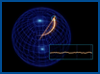 Earth Orientation Animations
03/01/2013 When you think of the Earth’s orientation, you’d probably imagine something like a globe, where it always rotates around an axis, called the spin axis, defined by the north and south poles. And while this generally makes sense, in reality, the Earth’s orientation is constantly changing very slightly, and this change can be described in three ways. Learn more about how the Earth's orientation changes by watching these animations.
 Read more
-
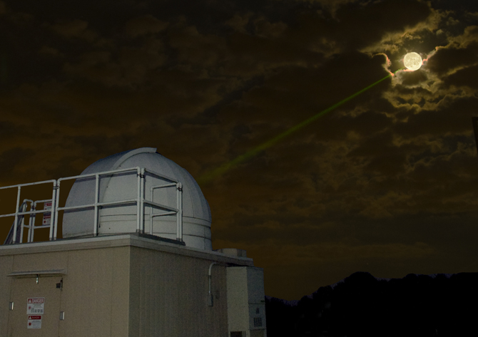
 NASA Beams Mona Lisa to Lunar Reconnaissance Orbiter at the Moon
01/28/2013 Laser communication and ranging experiments were successfully conducted from the satellite laser ranging (SLR) station at NASA Goddard Space Flight Center (GSFC) to the Lunar Reconnaissance Orbiter (LRO) in lunar orbit. The experiments used 4096-ary pulse position modulation (PPM) for the laser pulses during one-way LRO Laser Ranging (LR) operations. Reed-Solomon forward error correction codes were used to correct the PPM symbol errors due to atmosphere turbulence and pointing jitter. The signal fading was measured and the results were compared to the model.
The Mona Lisa Lasercom to the Moon from NGSLR demonstrates the potential of the SG Network beyond geodesy. The NASA news release was picked up by nearly all the major news outlets. Several members of the NGSLR team were co-authors of the paper which was published online in Optics Express.
Read the paper in Optics Express
Read the NASA news release
-
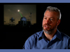 Stephen Merkowitz, Project Manager
07/05/2012 Project manager Stephen Merkowitz talks about his work with NASA's Space Geodesy Project, including a brief overview of the four fundamental techniques of space geodesy: GPS, VLBI, SLR, and DORIS.
Watch video
-
 Staff Profile: Jan McGarry, Mathematician
08/16/2012 Mathematician Jan McGarry discusses the science and history of Satellite Laser Ranging (SLR), her role in developing the Next Generation Satellite Laser Ranging system, and her career at NASA's Goddard Space Flight Center.
Watch video
-
 Chopo Ma, Space Geodesist
07/12/2012 Space geodesist Chopo Ma explains the science of Very Long Baseline Interferometry (VLBI): using radio emissions from distant galaxies to create a precise reference frame for the Earth.
Watch video
-
 Staff Profile: Carey Noll, Computer Scientist
08/02/2012 Computer scientist Carey Noll talks about her job as manager of the Crustal Dynamics Data Information System (CDDIS), the applications of her work for various space geodesy techniques such as GPS, and her career at NASA's Goddard Space Flight Center.
Watch video
Read project news